
Confidence is increasing that a significant winter storm will affect the Ohio Valley Tuesday through Thursday. Heavy snow will be possible with this system. Recent model runs suggest the highest snowfall totals will be northwest of Cincinnati and lower amounts will be found southeast. For now, here’s my thinking on the winter storm threat from Tuesday night through early Thursday:
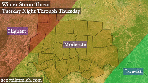
While the confidence for snow is increasing, there will likely be a a wide range on snowfall amounts in the Cincinnati area Tuesday through Thursday. The latest model runs suggest areas northwest of Cincinnati (especially north and west of the Tri-State over southern, central, and northern Indiana) may see several inches of snow, while areas southeast of Cincinnati will see considerably less.
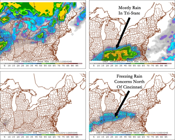
There is also a potential for ice accumulation with this system, especially Tuesday night and early Wednesday. The newest SREF model probabilities (from 10am this morning) also suggest a rain/freezing rain mix at 7am Monday morning, with the highest chance for seeing ice along I-70 from Indianapolis to Columbus:
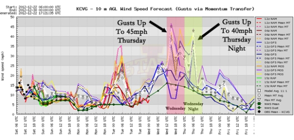
While the area of low pressure set to move through the Ohio Valley will be strong, winds will not be as strong with this system as they were over the last couple of days. The latest model guidance for Cincinnati has 10-25mph sustained winds Tuesday through Wednesday night and wind gusts up to 45mph Wednesday and Wednesday night:
It is still too soon to make a call on ice or snowfall accumulations with this Tuesday, Wednesday, and Thursday storm. More specifics will be released in the coming days…