
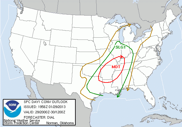
The Cincinnati area remains under a SLIGHT risk for severe storms late tonight and early Wednesday; the Storm Prediction Center has placed the southwestern Ohio Valley, the southeastern Mississippi Valley, and much of the Mid-South under a MODERATE risk for severe storms tonight and early Wednesday:
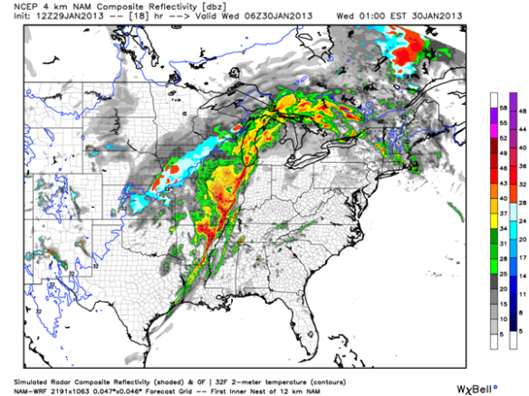
This morning’s model runs suggests damaging straight-line winds will be the main severe weather threat in the Tri-State early tomorrow. A line of showers and thunderstorms has already formed over the Mississippi Valley and southern Plains; this line will be pushing east through the night and tomorrow. The latest high-resolution WRF model has a squall line along the Wabash and Mississippi River at 1am tonight:
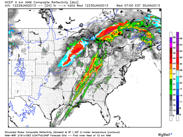
By 7am, the WRF has the squall line (and perhaps a secondary line showers and thunderstorms) moving the Tri-State:
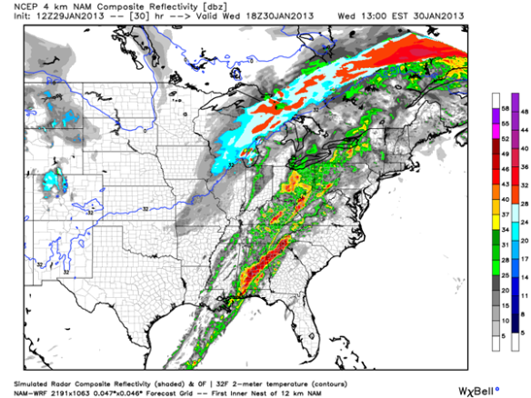
By 1pm Wednesday, the WRF has rain and thunderstorms moving east of Cincinnati and through the Mid-Atlantic/Carolinas:
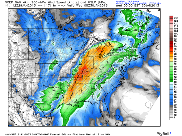
The WRF has a large swath of 60mph+ winds just above the ground (in orange and bright red) in the western Ohio Valley by midnight ET:
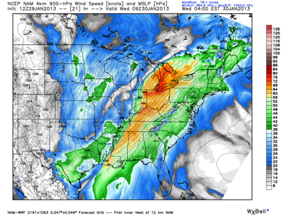
By 4am, that swath of gusty to damaging winds has pushed east into the Tri-State:
Strong winds may proceed storms late tonight.
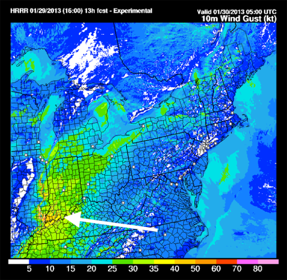
Even the latest HRRR model has damaging winds (near the arrow and as thunderstorms come through) in southern Illinois, southwestern Indiana, and western Kentucky by midnight:
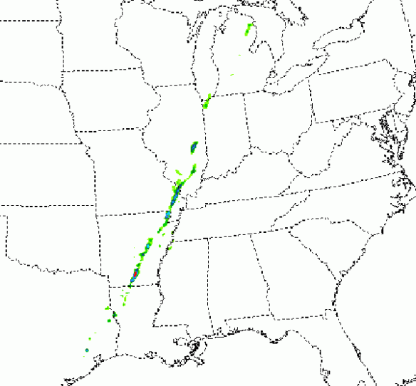
While the best tornado threat will be well southwest of the Tri-State early Wednesday, the tornado threat (while it is small) can’t be ruled out. SPC’s version of the WRF model has the best potential for rotating thunderstorm updrafts along the Mississippi River at 1am tonight:
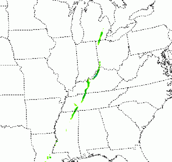
By 6am, the WRF suggest there may be some rotation in thunderstorms moving through the Tri-State:
Summary
Damaging straight-line wind continues to be the main severe weather threat locally early Wednesday. Tornadoes and large hail will secondary threats, with the greatest threat for each staying southwest of the Tri-State. Showers and thunderstorms will be moving through tomorrow morning between 2 and 11am, with the best threat for rain and storms (including strong and/or severe storms) between 5 and 9am.
Please stay safe and weather aware tonight and early Wednesday. Having a NOAA Weather Radio on and programmed correctly could save your life!