Confidence is high that much colder air is coming for Friday, Saturday, and Sunday. There is, however, some uncertainty on how much moisture will be embedded in this cold air nearing the weekend. The upper-level and surface support for flurries and snow showers is there, but how much upper-level and surface support we get remains in question.
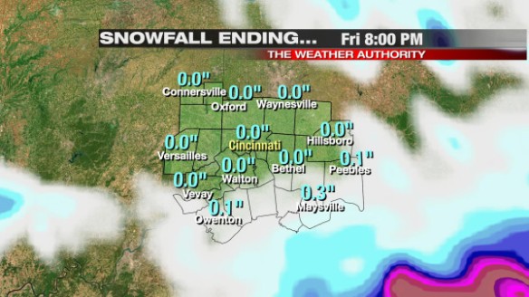
The latest run of Microcast has snow showers and flurries in the area tomorrow, as do most forecast models. Microcast suggests we will see little to no snow accumulation from tomorrow morning through Friday night:
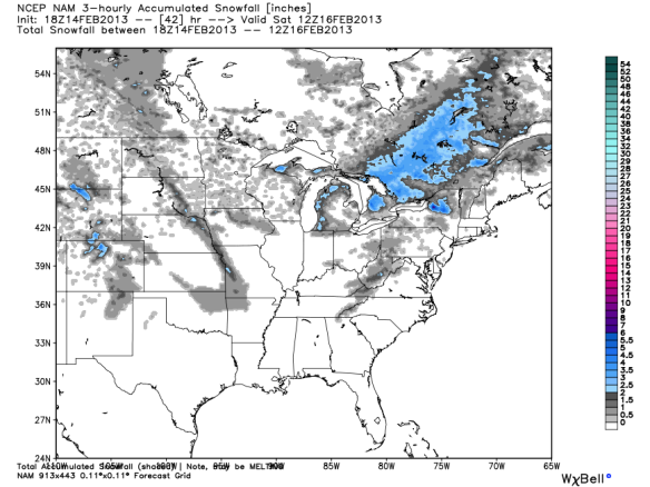
Nearly all models struggle with finer details, including specific snow amounts. I suspect there will be some instability in the area tomorrow, so quick bursts of snow are more likely than a large swath of snow in any given part of the Tri-State. You can see hints of these isolated pockets of heavier snow around Cincinnati in this afternoon’s NAM model snow output (through 7am Saturday):
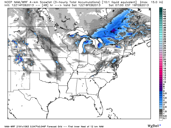
You can also see the isolated, heavier bursts of snow in this morning’s higher-resolution NAM model snow output (through 7am Saturday):
For now, Friday’s forecast calls for little to no accumulation for most, but there will be some localized bursts or bands of heavier snow. These small pockets of heavier snow may produce up to 1″ of accumulation. Of course, it is hard to predict where these small-scale features will set up, especially more than 12 hours out.
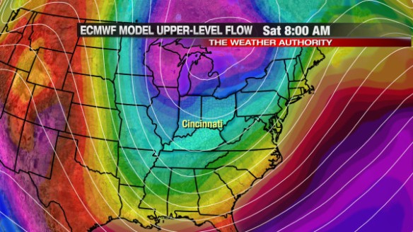
In addition to snow, we are also tracking the return of cold air for Friday, Saturday, and Sunday. This morning’s ECMWF model shows cold air (in blue and purple) diving south into the Great Lakes and Ohio Valley by 8am Saturday:
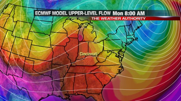
While it will be cold this weekend, the latest ECMWF model suggests the jet stream will push back to the north, and warmer air (in orange and red colors) will push back into the Tri-State by 8am Monday morning:
This warm-up will be temporary. A cold front will likely sweep through early Tuesday, bringing the return of cold air and snow by Tuesday afternoon.
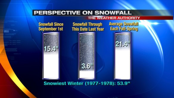
We love to hate snow in Cincinnati. Through this date last year, only 3.6″ of snow had fallen in Cincinnati. Since September, over 15″ of snow has fallen in the Queen City. Despite this being a warmer than average winter (so far), we will likely see a near average amount of snow for fall, winter, and spring as a whole: