
A strong cold front will sweep through the Tri-State early tomorrow morning, bringing rain this evening, a rain/snow mix overnight, and flurries tomorrow afternoon. Mid-week will be quiet, but another system coming later this week looks to bring the Ohio Valley a mess of rain, snow, sleet, and freezing rain.
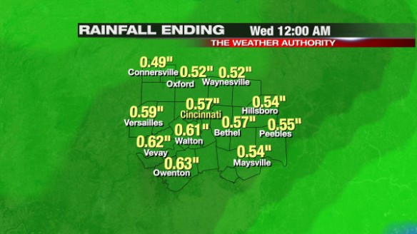
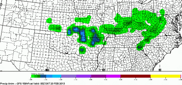
Everyone will see light rain tonight; some may see brief moderate to heavy rain. By the time this system pushes east tomorrow night, Precisioncast gives us roughly 1/2″ of precipitation (nearly all of this will be rain):
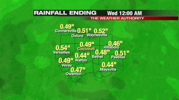
The higher-resolution Microcast run from this morning gives us about a 1/2″ of precipitation through tomorrow night as well:
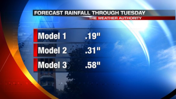
Besides Microcast and Precisioncast, the three major forecast models we use in the weather center give us anywhere between 0.19″ and almost 0.6″ of precipitation (mostly rain) through tomorrow night:
By tomorrow afternoon, we should only have flurries in the area with temperatures nearly steady in the low to mid 30s.
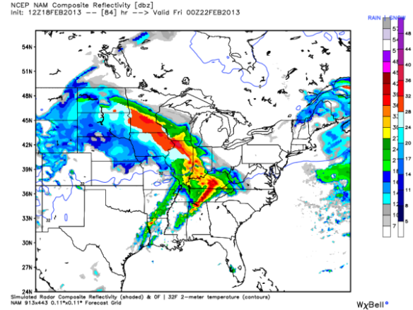
The weather system that is coming later this week looks more interesting and has my attention. A mix of rain, snow, sleet, and freezing rain is likely coming late Thursday and early Friday. The NAM model’s simulated radar product from this morning suggests we’ll see rain over ice by 7pm Thursday night, but I’m skeptical:
The latest run of the GFS model gives Cincinnati about 0.2″ of ice Thursday night and early Friday. Here’s a map of forecast ice accumulation this morning’s GFS model (through 7pm Friday):
Recent runs of the GFS model have given Cincinnati about 0.1 to 0.2″ of ice accumulation. This is not enough ice to bring down power lines, but it’s enough to make the roads slick. A difference of 2° in the temperature near or above the ground will make a big difference on how much rain, snow, ice, or sleet we get.