
A cold front will push through the Tri-State over the next couple of hours, bringing showers and thunderstorms to some but not all. Overall, late week looks quiet and cool.
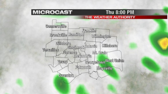
This morning’s run of Microcast does a nice job with cloud cover and rain chances through through tomorrow. Microcast keeps the the best chance for scattered showers and thunderstorms southeast of Cincinnati at 8pm tonight:
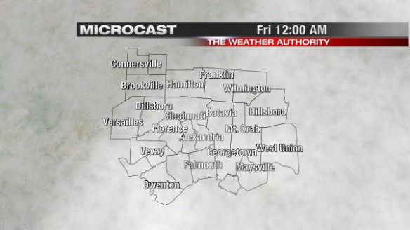
By midnight, we will likely still be mostly cloudy, but rain will be gone. Microcast has a good handle on this:
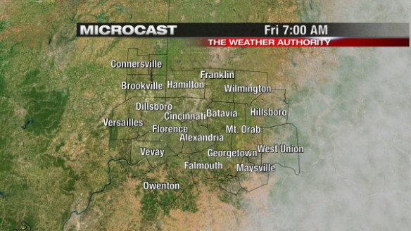
Clearing in earnest will begin just after midnight. By 7am, we’ll be clear, as Microcast shows:
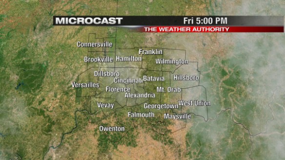
If you love sunshine without the heat, tomorrow will be a nice day. Microcast shows a sunny to mostly sunny sky overhead for tomorrow’s afternoon rush at 5pm:
It will be cool tonight, tomorrow, and into the start of the weekend. This morning’s WRF model suggest we’ll bottom out in the upper 30s and lower 40s Friday morning:
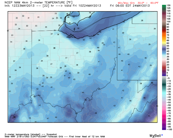
I don’t think we’ll be quite that cold by 6am Friday. Most will drop into the low to mid 40s tomorrow morning, 10-15° below average.
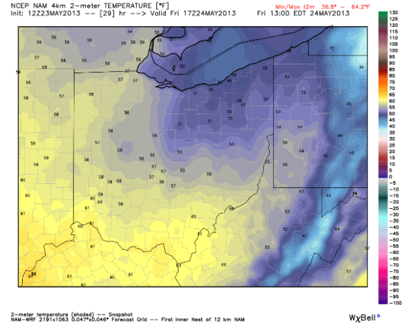
This morning’s WRF model suggests we’ll reach to near 60° by lunchtime Friday:
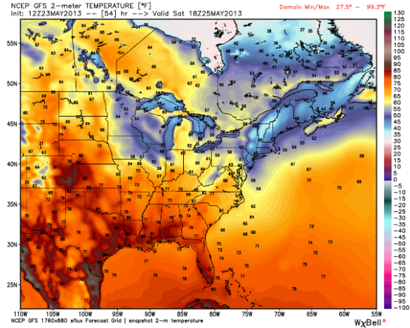
High temperatures tomorrow will be in the mid 60s. This morning’s GFS model suggests we’ll be in the upper 60s (orange colors) by late Saturday afternoon:
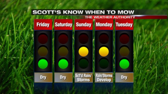
We’ll likely reach into the upper 60s and lower 70s Sunday, and into the 80s nearing the middle part of next week. If your yard isn’t soggy, you’ll be able to mow tomorrow, Saturday, and most of Sunday:
Scott- Interesting, enjoyed it. Question? We seem to have a greater number of days w/ likelihood of rain, our temp range has been lower than normal. Are we in some type of weather pattern unusual for us? Does the 90 day outlook for us show less rain, and more normal temps? Thanks so much
TB Mooney
Tom…the last couple of months have been cooler than average, and about average for precipitation. Recent data shows we’ll be near average for temperatures and rainfall over the next 90 days.
Scott- thanks for encouraging thoughts on outlook. It just seemed to me, and I may be wrong, but past 30 days at least seemed abnormal. Often they are the result of weather patterns such as jet stream(el niño etc.) but that is seldom mentioned in weather forecast , unless I just missed it. Maybe the overall public is not curious, and just takes a week at a time . But since the rise of weather patterns in relation to named patterns, and what they can cause, my interest has spiked. Thanks, T.Mooney