
The risk for strong and severe storms is in play tonight, but this is a limited threat for severe weather. Much of the Tri-State is under a marginal risk for severe storms tonight according to the Storm Prediction Center:
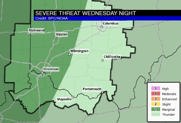
The threat for severe storms will be higher along and west of I-75. Storms that sweep through the Tri-State tonight will be moving quickly, approximately 40-50mph from the west to the east.
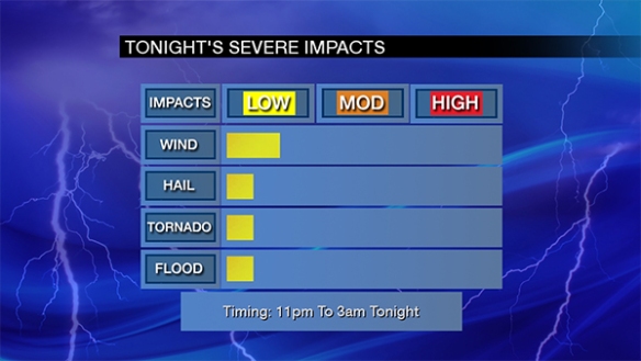
Damaging straight-line wind is the main threat with the strongest storms tonight. The most likely time for severe weather to occur is between 11pm and 3am:
As I have mentioned for days, clusters of rain and storms will weaken as they approach the Tri-State from the west tonight. This morning’s computer forecast models suggest showers and storms will stay to our west through 7pm:
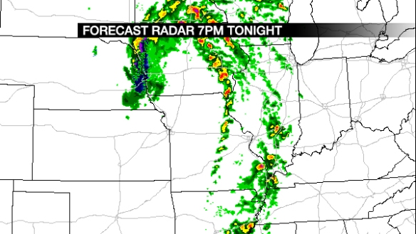
Clusters of rain and storms will move into the Tri-State late this evening and gradually most east of I-75 early in the overnight:
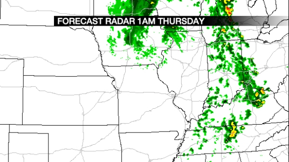
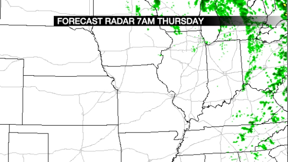
When you wake up and to head to work Thursday, showers will be widely scattered at best and focused east of Cincinnati:
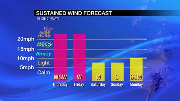
Regardless of how strong storms are tonight, the wind will remain strong Thursday and Friday; wind tomorrow and Friday will be due to the strength of low pressure positioned to our northwest and not from storms. Here’s my latest thinking on wind speeds and wind directions through this weekend:
While the threat for strong and severe storms is relatively low tonight, please stay alert for warnings. You are encourage to make sure your NOAA weather radio is programmed correctly and has fresh batteries this evening; fresh batteries will ensure that if your radio loses power from the A/C outlet, you will still be able to get warnings if you are sleeping.