
The Tri-State is in a slight to enhanced risk for severe storms this afternoon and evening. This is the highest threat for severe storms we’ve had so far in 2016.
The latest Storm Prediction Center outlook has the enhanced risk (the highest risk for severe storms over and southwest of Cincinnati this afternoon and evening; strong and severe storms are (slightly) less likely to the northeast and north of Cincinnati:
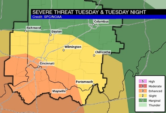
I encourage you to focus not on the severe threat category for which you live; instead, know that the threat for severe storms is higher in Cincinnati and points south and southwest of Cincinnati and slightly slower from Middletown to Hillsboro.
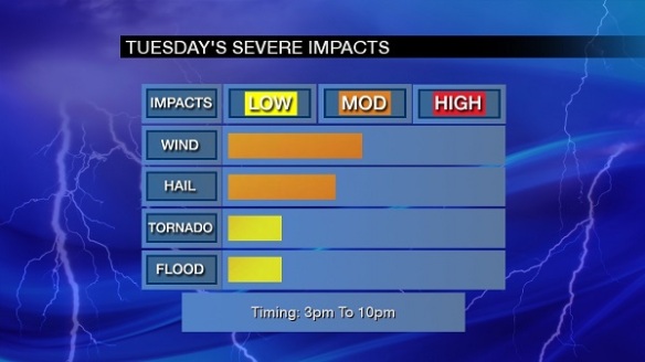
Based on radar, satellite, and model trends, it appears the highest threat for severe storms will be highest between 3pm and 10pm today:
What might the radar look like at various times today? One model, the High-Resolution Rapid Refresh, seems to have a decent grasp on rain and storm placement now. Here’s what it suggests the radar will look like at 2pm today:
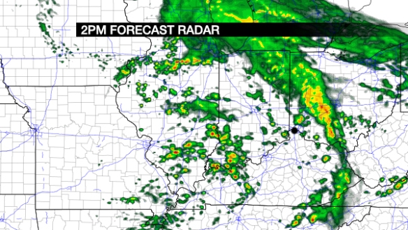
Notice the round of showers and storms that came through late in the morning exiting the Tri-State completely (to the northeast) by 2pm.
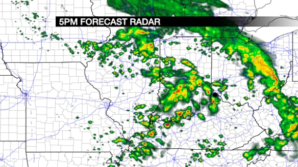
Forecast radar at 5pm shows showers and storms becoming more numerous:
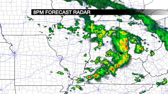
Forecast radar at 8pm shows showers and storms bowing and gradually pushing east of Cincinnati:
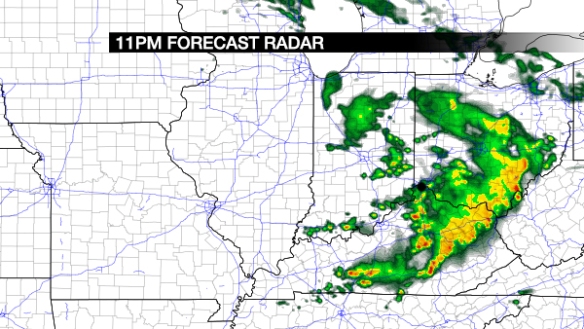
By 11pm, the High-Resolution Rapid Refresh model shows storms diminishing and pushing east of I-75:
Be prepared! Some storms may produce damaging straight-line wind and large hail. The strongest storms in the Ohio Valley will be capable of producing flash flooding and tornadoes.