As I highlighted in my Sunday blog post, there is a significant threat for severe storms Wednesday, Wednesday night, and early Thursday. Damaging straight-line wind was the main concern per yesterday’s guidance, and it still is the main threat. The tornado threat, though, has come up, but it is still a secondary threat at this time.
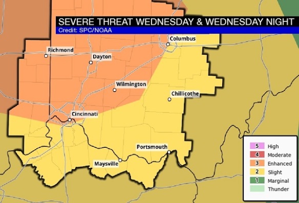
Just after 3am on Monday, the Storm Prediction Center placed the Tri-State in a slight to ENHANCED risk for severe storms Wednesday and Wednesday night:
The highest potential for severe storms is focused northwest of Cincinnati.
This morning’s guidance has shifted the main area of severe weather farther north into the Great Lakes. Despite this shift, we are still in a significant threat for severe storms Wednesday and Wednesday night.
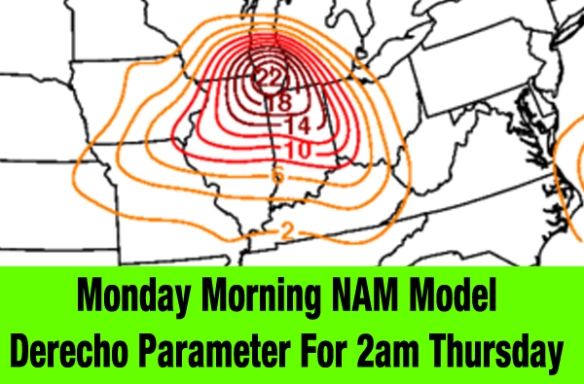
In yesterday’s blog, I discussed the derecho parameter. While I am not forecasting a derecho at this time, this parameter gives us an idea of how high the damaging straight-line wind threat is IF storms occur. Here’s what this morning’s NAM model thinks the derecho parameter will be at 2am Thursday morning:
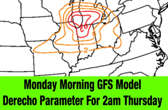
Clearly, these are high values (anything over 5 is very significant, really) over the Great Lakes and Ohio Valley. Here’s what this morning’s GFS model thinks for the same time:
While values are not as high, they are still high.
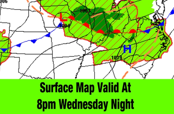
While computer guidance suggests the complex of storms may stay focused to our north, the Weather Prediction Center suggests there will be warm front (the leading edge of warmer air bisecting the Tri-State) Wednesday night:
The air mass lifting in from the southwest will be warm, humid, and unstable, and the front will help provide shear (the change in the speed and direction of the wind). All of these elements combined elevate the threat for tornadoes and damaging-straight wind locally (despite a higher threat closer to Chicago).
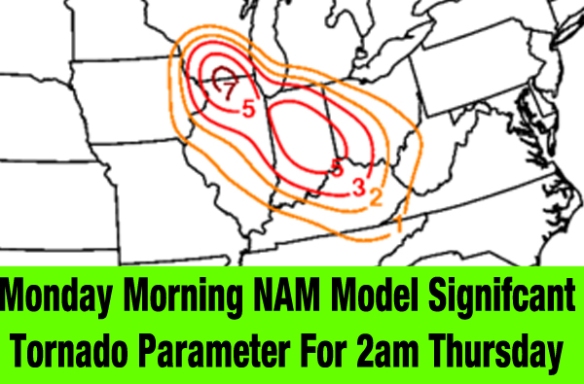
The Significant Tornado Parameter tells us where there is a elevated risk for tornadoes IF storms can form. Number greater than 1 are usually supportive of at least the potential for tornadoes. Here’s what Monday morning’s NAM model has the significant tornado threat at for 8pm Wednesday night:
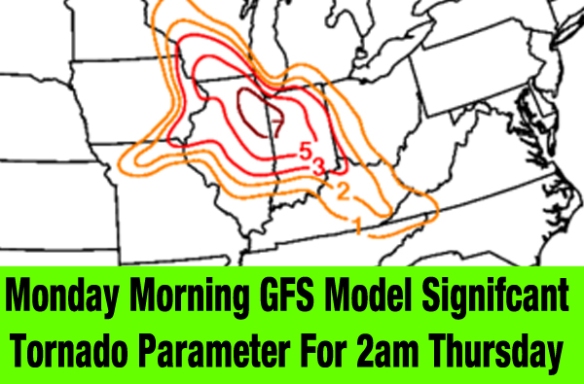
This is elevated. Let’s see what Monday morning’s GFS model has for the same time:
This is also elevated. Notice that this does not guarantee tornadoes, but it does show us the magnitude of the tornado threat.
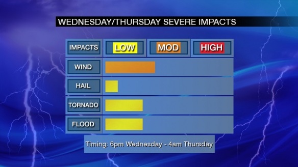
It is also important to note that model guidance is NOT is not a forecast. A meteorologist must review other guidance to make a forecast, and here is what I have come up with for now regarding late Wednesday and early Thursday’s severe weather threat:
This forecast may change as model guidance changes and as we near the event. Know that the damaging straight-line wind threat and tornado threat are both in play for late Wednesday and Thursday. I’ll update this blog as needed.

