
In the Ohio Valley, it is rare to be put in a severe weather risk area by the Storm Prediction Center more than 3 days out. This week will feature one of those rare occasions.
The Storm Prediction has put the Tri-State in the 15% severe storm risk for Thursday. The 15 percent risk means SPC feels there is a 15% probability of a tornado, severe hail, or severe wind event occuring within 25 miles of a point:
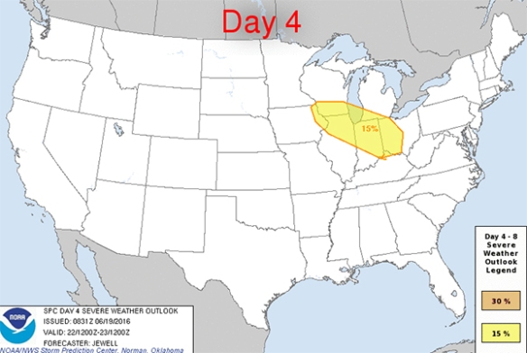
This is – essentially – a “slight” risk for severe storms on Thursday. The 30% area would be the equivalent of an “enhanced” risk. “Marginal,” “moderate,” and “high” risk equivalents are not issued on forecast days 4 through 8.
The takeaway here is that the Storm Prediction Center feels there is a significant severe weather threat in the Great Lakes and Ohio Valley Wednesday.
Or will it be Thursday? Models disagree on the timing of this mid-week storm threat.
There is already a buzz on social media about a complex of storms racing through the Midwest and Ohio Valley Wednesday. Some are predicting a “derecho” (a long-lived complex of storms that causes wind damage over a large area), which predicting at this range is not worth our time and ridiculous. The definition of a derecho is loose. The SPC believes a derecho must go 250 miles and contain separated 75mph wind gusts. Others disagree that a derecho needs to fulfill this requirements.
Regardless, let’s investigate this severe threat using the derecho parameter, which suggests where derechoes may grow or evolve IF storms are able to occur. The higher the derecho parameter, the better the support for them. Here’s what Sunday morning’s NAM model suggests the derecho parameter will be at 2pm Wednesday:
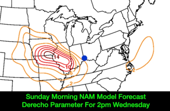
Clearly, there is a significant risk for storms with damaging wind to our west Wednesday afternoon if you believe this model. Let’s compare it to Sunday’s morning’s GFS model:
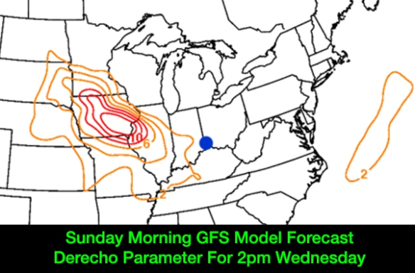
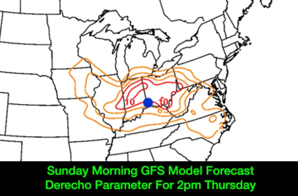
The GFS is not as impressed with the threat compared to the NAM, especially for Indiana. It is a model model with a different engine, but it is still showing a significant risk for storms with damaging straight-line wind. The GFS model actually holds the better threat off until Thursday:
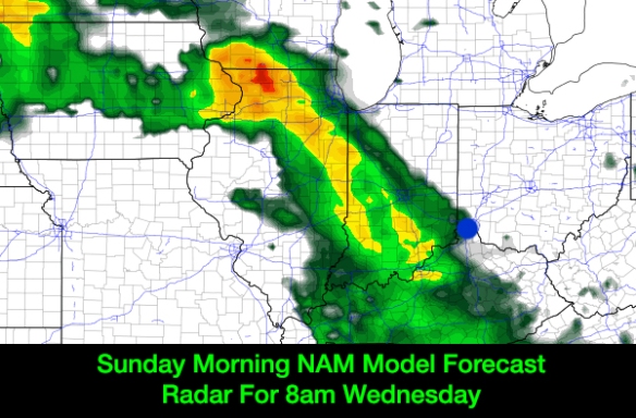
The NAM model produces a future radar product. Here’s what Sunday’s morning’s NAM model suggests the radar might look like Wednesday morning:
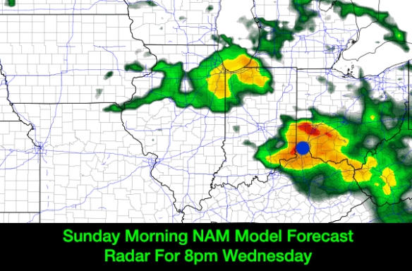
…and here’s what it suggests the radar will look like 12 hours later:
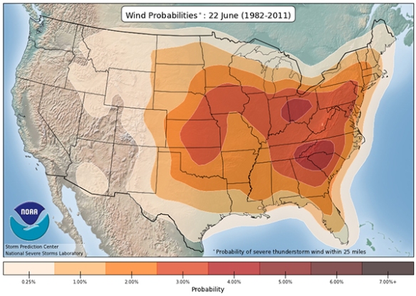
Even history suggests we need to watch for a damaging straight-line wind threat. The Storm Prediction Center’s database suggests the historical odds of seeing severe weather on June 22 is focused over the Tri-State, central Plains, and Carolinas:
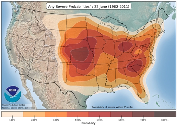
When severe weather occurs in the Ohio Valley on June 22nd, it is very likely to be a damaging straight-line wind report versus a tornado or large hail report:
It is apparently that we need to monitor the damaging straight-line wind threat later this week, although tornadoes and large hail are possible with any storms that sweeps through the Ohio Valley. Our confidence, however, is muted when we see discrepancies in model guidance. The last two runs of the European forecast model (ECMWF) suggest the damaging straight-line wind threat will peak late Wednesday night or early Thursday. It is the “middle of the pack” right now.
Stay tuned. Wednesday and Thursday are days to be prepared for strong and severe storms.