On Tuesday afternoon, the National Weather Service in Wilmington, Ohio confirmed an EF-0 tornado in central Highland County that lasted approximately 4 minutes (from 8:39 to 8:43pm) Sunday evening. According to the damage survey, the tornado produced wind speeds up to 85mph and created a swath of damage 2.5 miles long. The tornado length is the 9th highest on record for any EF-0 Tri-State tornado since 1950.
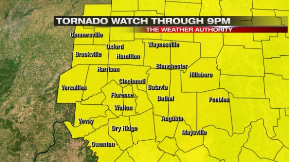
At 1:45pm ET on Sunday, the entire Tri-State was put under a Tornado Watch:
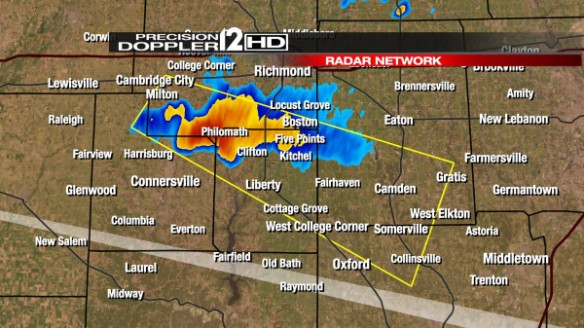
In addition to SPC’s slight to moderate risk for severe storms issued days in advance, this was an early indication that tornadoes would be possible Sunday afternoon and evening. Many – including me – weren’t buying into the need for a watch Sunday afternoon. Afternoon clouds only allowed spotty showers to form. Showers and storms finally started to move into the Tri-State and intensify slightly after some late day sunshine. There was one Severe Thunderstorm Warning issued for a part of the Tri-State Sunday night: A Severe Thunderstorm Warning for Fayette, Union, and Butler County issued at 6:26pm…
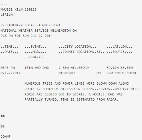
This warning did not verify. Showers and storms were spaced out for much of the evening and were not particularly strong. There was a report of a tree down on a house in Independence, Kentucky around 8:30pm, and that was the only report of damage for quite a while. Reports of damage came in late from Highland County; the first report of damage from Highland County came about 45 minutes after the damage had occurred:
This is not an uncommon report to have after a severe storm. It was a bit surprising to see the report given that no Tornado or Severe Thunderstorm Warning was issued for Highland County and radar data suggested there would be some areas of strong but sub-severe winds.
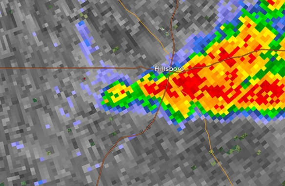
What exactly did radar data show? Here is the reflectivity scan (showing shower and storm intensity) from the NWS Wilmington, Ohio radar at 8:38pm Sunday night:
The tornado was confirmed southwest of Highland County, and it is clear that showers and storms in the area were intense. These showers and storms had good inflow, but there was no pronounced hook echo. What did the Doppler part of Doppler radar show?
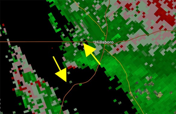
Storm relative velocity data from NWS Wilmington’s radar showed strong winds moving toward from the radar (green) south of Hillsboro around 8:40pm. The red pixels on the southwestern flank of this storm showed winds on average moving away from the radar in Wilmington. These red and green colors are not close together or bright, suggesting little or no rotation. Some storms in the Tri-State had stronger rotation Sunday night, and they did not produce tornadoes. What made this storm a troublemaker?
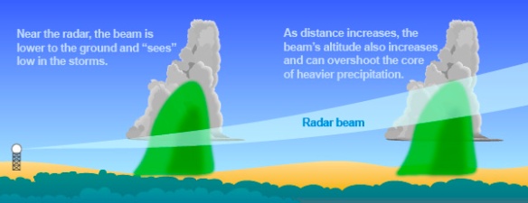
The real problem here is the radar data. This graphic from NOAA shows why this storm likely didn’t receive a warning:
Where the tornado began, NWS Wilmington’s radar beam was scanning about 1,100 feet above radar level (the radar is about 100 feet off of the ground in Wilmington). Despite being one county away from the radar site, the beam was likely too high to see the tornadic circulation or any parent circulation. Even with a recent upgrade – called SAILS – to the radar, the upgrade does not allow the radar to scan closer to the ground. The upgrade allows low-level scans to come from the radar during times of active or severe weather, but the upgrade does not give meteorologists the ability to see all tornadoes, including if they are far from the radar site.
The lowest scan from nearly all of the NWS radars covering this country is 0.5° above the ground. Why? Honestly, it’s fear of people getting blasted with radiation from these radars. The sun gives off a lot more radiation every day, but people aren’t constantly lathering up on sunscreen every time they go outside.
For years, the FAA has operated a radar in Kenton County, continuously scanning at 0.1° above the ground. To my knowledge, I’ve seen no complaint about this radar emitting radiation even closer to the ground than the NWS’ radar. Why should we be so considered with an NWS radar scanning at 0.1° instead of 0.5°? This fear of radiation and the bureaucracy surrounding it may actually be putting lives at risk. Lower-level scans will likely improve lead times on Tornado Warnings and Severe Thunderstorm Warnings. Lower-level scans will allow us to track hazardous weather with more accuracy. Why would we not want this?
Despite all of the improvements made to radars over the years (from more frequent updates to higher resolution to even more radars), the lowest-level scan is not getting any lower; this needs to change. The benefits of lower-level scanning outweigh the consequences; an upgrade that involves lower-level scan angles will allow us see tornadoes like the one that hit Highland County Sunday night with ease.

I see your point, but there are other issues to consider. The beam width for the WSR-88D may not allow a tilt to go that low without a significant amount of its radiated power hitting the ground. Consequently ground clutter will also increase. And don’t TWDRs emit less power than the WSR-88Ds do? (250 kW vs. 750 kW?)
Unfortunately the laws of physics may be a worse enemy than the weak hit-and-run tornado!