This is a mind bender. Imagine you’re nearly certain something is happening and is a threat to someone’s life…then after an additional investigation, nothing happened.
There was a rotating thunderstorm in northern Brown County Sunday night around 1am. It needed a Tornado Warning, and it got one. Shortly after the warning was issued, there was a tornado debris signature, which essentially confirmed a damaging tornado was occurring (based on radar).
I put my own credibility on the line to highlight what I saw on Facebook:
I did the same on Twitter…once to highlight the original warning:
Storm moving northeast at 35mph. TAKE COVER NOW Hillsboro and surrounding areas! #cincywx https://t.co/Sk3hxIZaUg
— Scott Dimmich (@ScottDimmich) November 6, 2017
…and the second to emphasize the radar confirmation of a tornado:
THIS IS A RADAR CONFIRMED TORNADO and DAMAGING southeast of Fayetteville. Take cover NOW. #cincywx https://t.co/3jO0bkSNUH
— Scott Dimmich (@ScottDimmich) November 6, 2017
This is the “usual” shower and thunderstorm mode of radar – formally called reflectivity – during the warning:
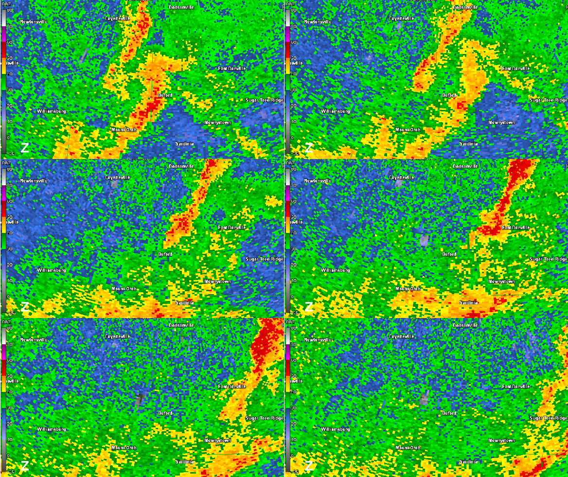
If you look carefully and near Buford (north of Mount Orab), you might see a hook-like feature, signaling a possible tornado. This isn’t easy to see, so let’s look at the Doppler part of Doppler radar, which will tell us how winds are moving relative to the radar:
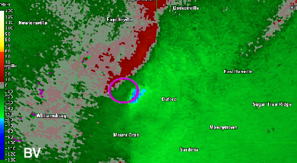
In pink, I’ve circled what is called a couplet, or an area where winds are moving towards and area from the radar in close proximity. Red here means winds are moving away from the radar, and green colors means winds are going towards the radar. The environment around this storms has to be supportive of tornadoes in order for us to see this as a tornado; in this case, there was support for strong, severe, and tornadic storms. Let’s subtract out the overall motion (speed and direction) of the storm so we can see the storm relative motion. If you’re still confused, think of it like this: it’s easier to assess the rotation of a toy top on a table if it’s nearly stationary versus moving rapidly across a table. Here’s the storm relative velocity animation:
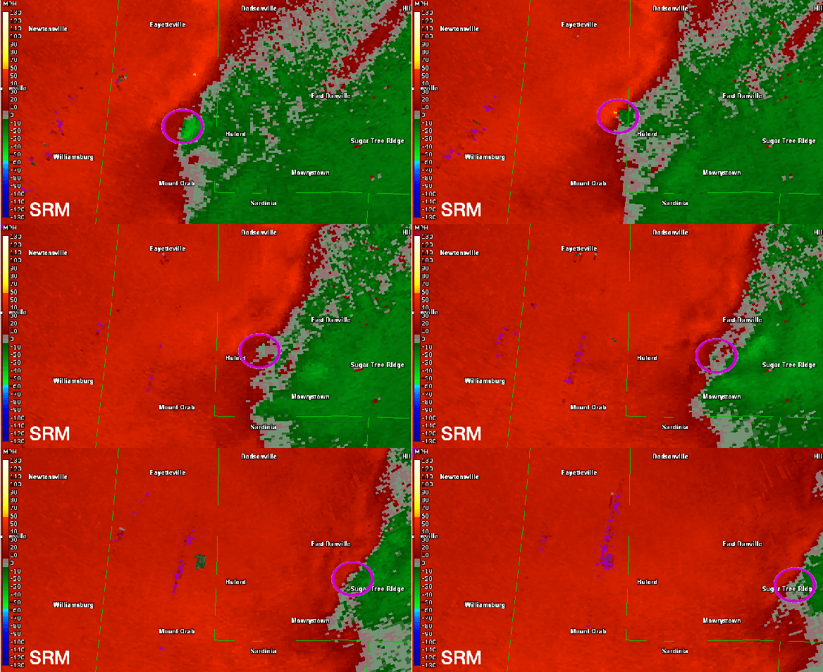
Again, I’ve highlighted a couplet with a pink circle. That’s strong rotation slowly weakening as it goes east.
Modern, dual-polarization radar can tell a meteorologist about the size and the shape of objects it scans, relatively speaking. If a radar scans a “bin” of the atmosphere and finds objects of varying shapes and sizes, that bin’s targets will have a low correlation. If a radar scans a “bin” of the atmosphere and finds objects of similar shapes and sizes, that bin’s targets will have a high correlation. To quantify this, we’ll turn this correlation into a correlation coefficient. Here’s the animation of this correlation coefficient just after 1am Sunday night:
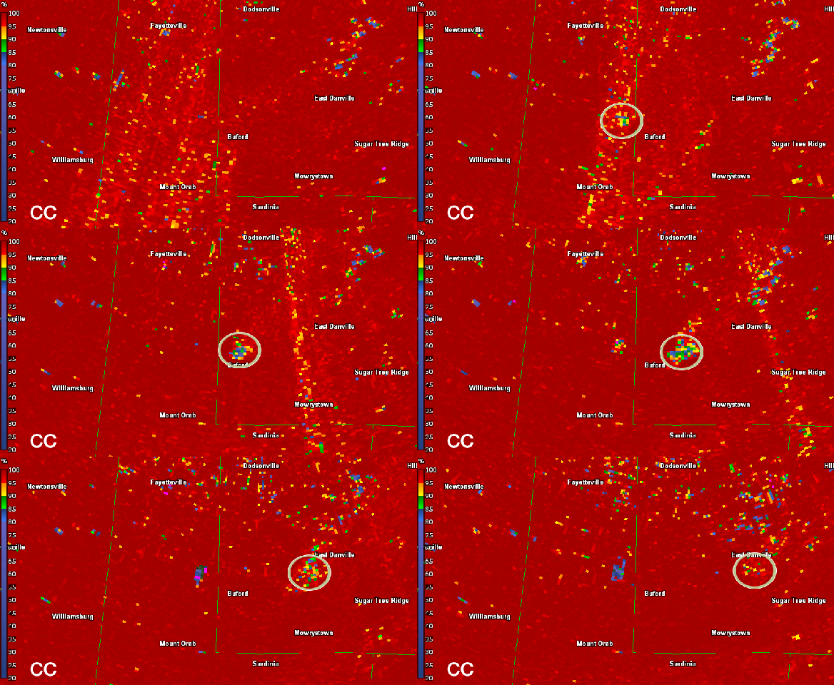
I’ve circled a consistently low correlation area moving east. This area is basically the same area with strong rotation and a strong thunderstorm. As a meteorologist, this area low correlation coefficient within the area of a strongly rotating thunderstorm signals that a damaging tornado has occurred. The higher up in the atmosphere this low correlation coefficient goes, the more likely there is a damaging tornado and the more likely the tornado is to be strong. That low correlation coefficient area went up to about 5,200 above radar level:
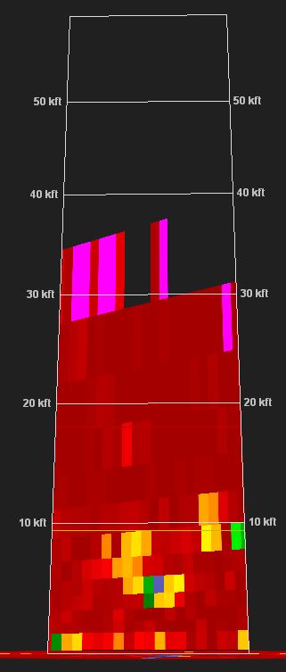
The actual altitude is greater when you consider the height of the radar and the curvature of the Earth.
This signature (the combination of the storm, strong rotation, and low correlation coefficient) is called a tornado debris signature. Now you see the reasoning for my Facebook post and tweets above. This is clearly a dangerous situation.
The Tornado Warning ends in about 30 minutes. The storm weakens, and order is restored.
Let’s fast forward to this morning. The National Weather Service plans to survey the area for damage. The damage is surveyed, and the NWS has a verdict:
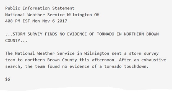
What? What happened here? We had a tornado debris signature last night.
I asked a radar expert for a second opinion:
Radar clearly shows nonmet. scatterers. Could be light debris like leaves (it's fall, after all) that wouldn't show as damage in survey?
— PSURadarMeteorology (@PSU_RadarMeteo) November 7, 2017
stuff caught along convergence line could be swept into circulation. Great case! Blurs line of weaker circulation on ground vs. tornado.
— PSURadarMeteorology (@PSU_RadarMeteo) November 7, 2017
Professor Matt Kumjian of Penn State makes a good point: it’s a blurry area. A low-level circulation with leaves in it is not a tornado. Another broadcast meteorologist – Ryan Hanrahan – suggested a drone may be helpful in a damage survey. Joey Picca of the Storm Prediction Center also has some thoughts:
What Matt said up top. It’s a TDS to me. Tornado or not… that’s a much deeper question.
— Joey Picca (@ScienzaPiccola) November 7, 2017
I don’t know how “exhaustive” the search was by the NWS, but apparently they didn’t see anything of interest. Maybe it is a false positive. But the radar in this case is like a camera witnessing a crime where police later find nothing at the scene. Or the radar shows a series of facts but the jury says not guilty.
What do you think? I think I’m frustrated.

I would agree with sending a drone up for an aerial survey. The area where the possible tornado is wooded and open farm land . It is possible a tornado could have touched down in a wood area that would have to be hiked in to see any damage. Maybe just tree top damage?
You’re frustrated? I’m beyond that lol. I just enjoy reading your posts. You are a brilliant young man and I trust your employer recognizes that and will reward you accordingly. Thanks for sharing your unending love of weather with us!
It may have been a something like a “triplet” instead of a couplet. Wind going east to north, north to west and the South to East Windsor… Depending on the radar location. It would look like it is doing nothing because one of the three wind directions is not moving forward or away from the radar.
I’m essence it would end up looking like acouplet but it only is represented in two of the three directions (forward and backward). This would have an effect of three large mesovortexes or directional drafts. Creating the pattern in the middle of the screen but only as an interaction of the larger drafts.
Just one of many explanations 0.0
Maybe the debris was just a giant drove of angry bees upset by the massive wind rift. Naturally dispersing like ninjas before twistex arrived…
Scott, it’s always a pleasure to hear your professional and brilliant take on the weather. Thank you for continuing to enlighten us!