Our recent warming trend will continue through Saturday. In addition to tracking high temperatures in the 50s and 60s, the week ahead will feature several chances for rain; some of the rain – especially this weekend – may be heavy.
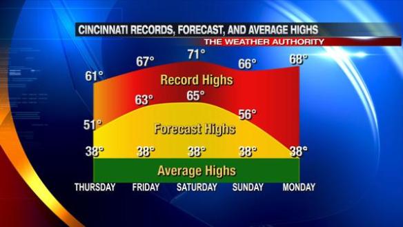
The latest model guidance suggests high temperatures will be near 50° tomorrow and in the low to mid 60s Friday and Saturday. While high temperatures will be 20-25° above average Friday and Saturday, record high temperatures will not be broken or tied.
Here’s how record, forecast, and average highs compare Thursday through Monday:
The record high for both Friday and Saturday were set in 1890. 1890 ended up being the 16th warmest year on in Cincinnati.
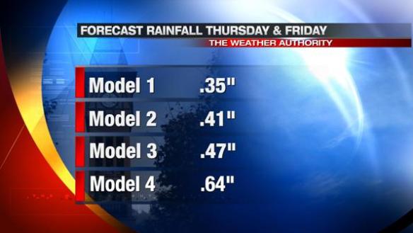
While it will be warm, the next few days will also be rather wet. Models suggest about 1/2″ of rain will fall from tomorrow morning through Friday afternoon:
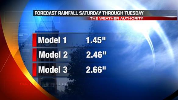
Heavy, widespread rain is coming this weekend and early next week. The heaviest rain will likely be in our area Saturday night through Monday morning. The latest model data suggests 1-3″ of rain will fall from Saturday to Tuesday:
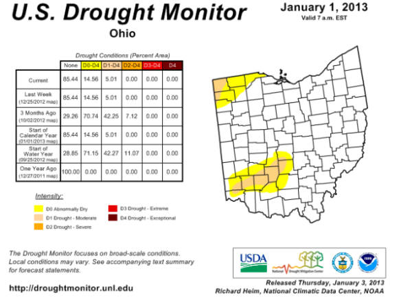
While it hasn’t been discussed in a while, the latest NOAA Drought Monitor (issued January 1) shows areas along and north of I-71 are either abnormally dry or in a moderate drought:
While the rain coming tomorrow, this weekend, and next week may get in the way of your outdoor plans, it will be beneficial.


