
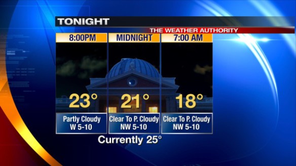
The area of low pressure that gave the Tri-State a quick shot of snow is heading east in a hurry; high pressure over the Mississippi Valley is already moving in from the west. The clearing line along the Indiana/Illinois border now will be moving into the Tri-State early this evening. By late evening, the sky overhead will be clear to partly cloudy. Tonight’s hour-by-hour forecast shows temperatures falling into the upper teens late:
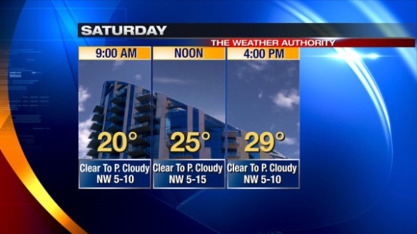
High pressure will settle into the Ohio Valley Saturday. With high pressure nearby, ample sunshine is forecast tomorrow morning, and a partly cloudy sky is forecast Saturday afternoon:
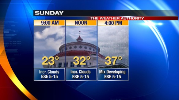
High pressure will push east Saturday night and early Sunday, allowing low pressure to move in from the west. Mid- and high-level clouds will increase Saturday night, and only filtered sun is expected Sunday. Sunday’s hour-by-hour forecast shows a mix of freezing rain, sleet, snow, and rain developing in the Tri-State Sunday afternoon:
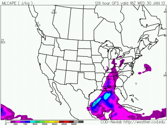
Temperatures will be above freezing most if not all of Sunday night, so the mix of precipitation types will likely transition to all rain by early Monday morning. Only rain is forecast Monday afternoon through Wednesday. While there are large model discrepancies in next week’s forecast, the latest GFS forecast model shows some limited instability (shown in purple) in the Tri-State Wednesday afternoon:
For this reason, a mention of thunderstorms will be put into the forecast Wednesday.
Cold air is likely to return late next week. Little to no snow accumulation is expected Thursday as a cold front sweeps through the Ohio Valley.