
The threat for freezing rain, rain, snow, and freezing rain is still forecast Thursday night. Here in the Tri-State our main focus will be for freezing rain and rain. We don’t always see ice in the winter; this may be our best chance to see ice this season.
There is still uncertainty in the timing, positioning, and strength of this system. A 2° difference in temperature near or above the ground will make a big difference for what type of precipitation you’ll see and when.
For now, it appears our main threat for freezing rain will be between 10pm Thursday and 5am Friday morning. There will be a lot of lift in the atmosphere as this system pushes through the Ohio Valley; there may be some localized pockets of heavier freezing rain and rain Thursday night and early Friday.
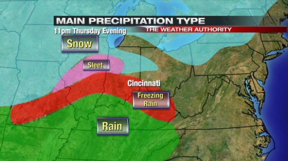
Around 11pm tomorrow night, freezing rain will develop in and around the Tri-State, while rain will be favored to our south and snow and sleet will be favored to our northwest:
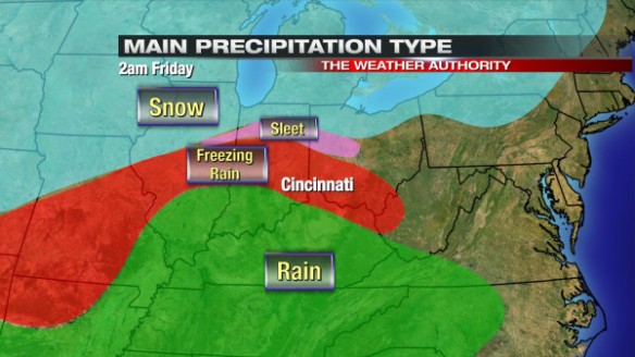
By 2am, the threat for freezing rain ramps up in and around Cincinnati:
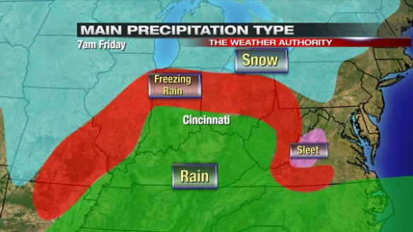
By 7am Friday, the odds of rain will be going up as the threat for freezing lifts into northern and central Ohio:
While it may be precipitating heavy at times Thursday night and early Friday, air, pavement, and ground temperatures will be hovering around 32°. This limits the potential for ice accumulation tomorrow night some.
How much ice are we getting? It depends on where you live and which model you believe.
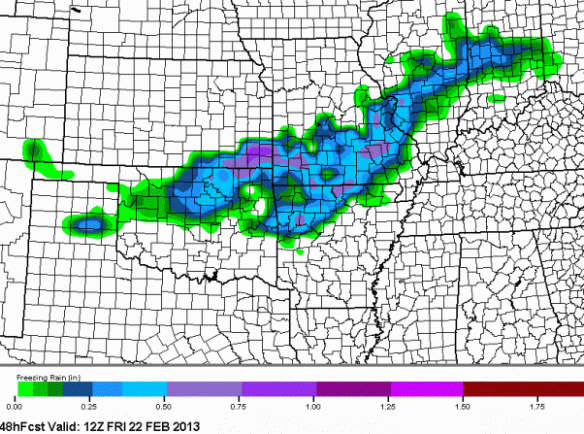
This morning’s NAM model keeps the best threat for ice accumulation northwest of Cincinnati and back into the Mississippi Valley:
This morning’s GFS model is more aggressive with ice accumulation in our area, giving most at least a light glaze:
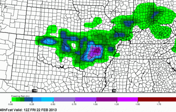
This morning’s Microcast run is the most aggressive with ice accumulation Thursday night and early Friday. It is highly likely that these amounts are overdone; if this verified, this would be a crippling ice storm, and we are NOT expecting this:
Precisioncast is more realistic with ice amounts, but still may be too aggressive:
Forecast
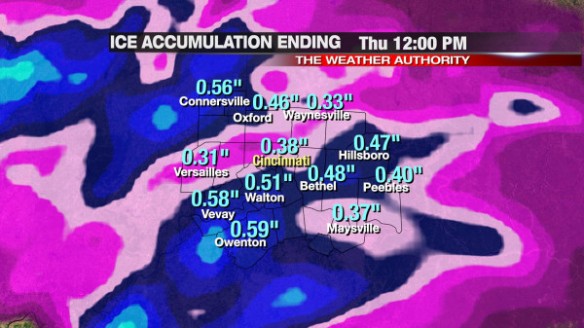
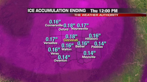
I still think it is too early to make a specific, county-by-county ice accumulation forecast, but the threat for a widespread, light glaze Thursday night and early Friday is rising. A 1/4″ of ice usually causes power lines to sag or fall completely to the ground; I’m not ready to commit to the possibility of this happening anywhere in the Tri-State yet. Given the lack of consensus in model data, I will not release a specific ice accumulation forecast. Regardless of how much ice falls, it is important to know that roads may be slick and that elevated, cold, outdoor surface may have a coating of ice by late Thursday night.
I may do a video update late tonight, depending on how much time I can find tonight. I will update this blog tomorrow.