
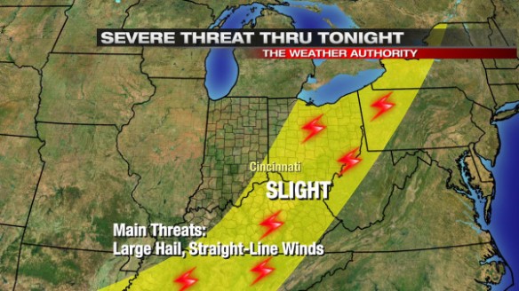
Strong storms are possible not just through early evening in the Ohio Valley, but also nearing midnight as a cold front nears. The latest severe weather outlook from the Storm Prediction Center has much of southwestern Ohio and northern Kentucky in an elevated risk for severe thunderstorms through tonight:
The latest round of model data is messy with the handling of showers and thunderstorms tonight and very early Sunday morning. Visible satellite shows why models are struggling:
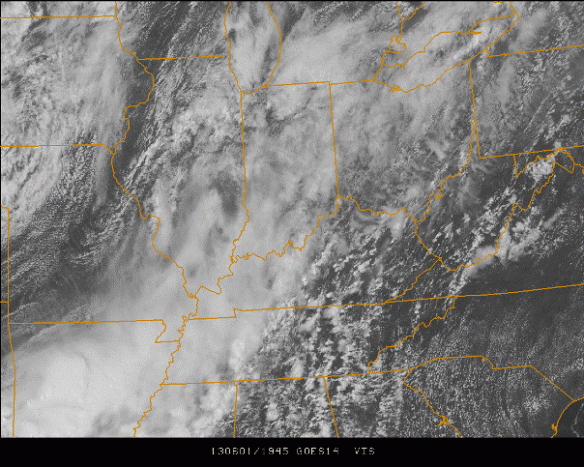
As of 3:45pm, you can see breaks in the clouds over central Kentucky, eastern Kentucky, and southwestern Ohio. Meanwhile, much of central Indiana and western Kentucky was cloudy, and there was more clearing ahead of the cold front pushing through Illinois. The setting sun will mean decreasing instability, further complicating the forecast.
Instability has been limited all day thanks to showers moving through early this morning and clouds slow to thin out this afternoon. While there is some wind shear (winds changing direction and speed going away from the ground) and some support for spinning thunderstorms in our area, instability is relatively weak, so the coverage of storms is rather low. As a result, the threat for severe weather is muted.
While there are some significant disagreements on the timing of showers and thunderstorms tonight, this morning’s Microcast model run matches my thinking fairly closely. Here’s what it thinks for shower and thunderstorm coverage at 8pm:
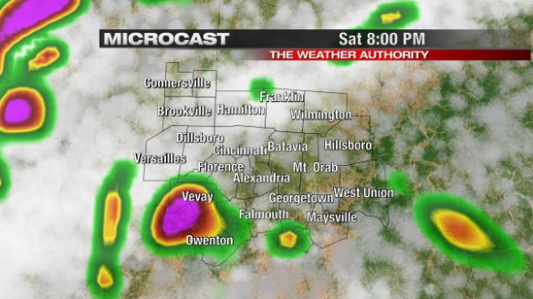
While the placement of showers and thunderstorms is likely off, the model suggests rain and thunderstorms will be scattered at that time. Some strong storms, especially south and east of Cincinnati, will likely linger through early evening.
By midnight, Microcast has showers and thunderstorms along the cold front (now to our west) moving into the Tri-State:
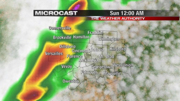
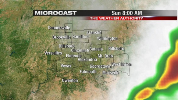
Brighter colors on Microcast here suggest some pockets of heavy rain, gusty winds, and lightning with the stronger cells in the line that forms. By 8am Sunday, showers and thunderstorms will be to our east, and we’ll enjoy a blend of sun and clouds:
In summary, the chance for showers and thunderstorms will be ramping up through the evening as the cold front nears. Damaging straight-line winds, heavy rain, large hail, and lightning will be possible with any strong storms that are able to form. Despite this being a short-term forecast, there is still a considerable amount of uncertainty about the timing, placement, and intensity of thunderstorms through the evening and overnight. Please be alert to the threat for strong and severe storms through Sunday morning!