As you probably noticed, the chance for showers and storms in the Tri-State Tuesday night was overdone. Even on-air at 5pm Tuesday, I mentioned a threat for severe weather – especially west of Cincinnati – and scattered showers and storms. I played the threat down on-air tonight, but the radar tonight suggested I didn’t play it down enough.
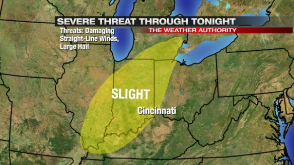
At 2pm Tuesday, the Storm Prediction Center had the western half of the Tri-State and most of Indiana under a slight risk for severe storms:
As a broadcast meteorologist, you need to present this threat, even if you don’t fully agree with the Storm Prediction Center. I’ll agree with the Storm Prediction Center that there was adequate low-level moisture, warmth, and instability available for thunderstorms to form and become strong or severe.
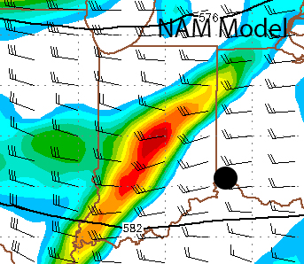
The missing piece – or at least the piece that was most in question – was the upper-level support. Tuesday morning’s NAM model showed the upper-level disturbance (yellow/orange/red) approaching Cincinnati (the black dot) at 8pm Tuesday:
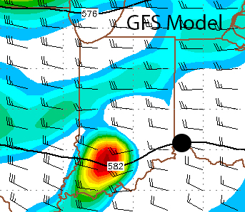
Ahead of a disturbance like this, lift in the atmosphere increases, and the chance for storms – including severe storms – increases. Tuesday morning’s GFS model showed a disturbance of similar strength approaching the Tri-State at 8pm Tuesday:
Two models showing a disturbance moving through the Ohio Valley raises confidence about the coverage and intensity of showers and storms. The GFS model was farther south with the disturbance, and the NAM model had the disturbance more spread out.
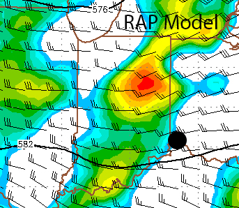
It is hard to verify exactly where these disturbances were Tuesday evening (given they are 18,000 feet above the ground), but the 9pm run of the RAP model (which updates every hour) is our best hope for verification. Here’s where it placed upper-level disturbances at 10pm Tuesday night:
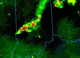
Clearly, the RAP has the strongest disturbance northwest of Cincinnati and has it more compact than the NAM model. Showers and storms developed well to the northwest of Cincinnati on the nose of the upper-level disturbance Tuesday afternoon, and outflow from the early evening storms supported new storm development through late evening (as 11pm Tuesday radar shows):
Models clearly missed the mark, and as a result, the forecast could have been better. Just like in the winter where the exact track has a big impact on snowfall totals, the track of this disturbance had a big impact on the placement and strength of showers and storms.

