
As I mentioned in my last blog post, there is a secondary severe weather season in the Tri-State. There is often an increase in the number of tornadoes, Tornado Warnings, and Severe Thunderstorm Warnings during the fall as the jet stream strengthens and low-level moisture increases ahead of strong fronts. Late tonight and early Friday is one of these cooler-season opportunities to see strong to severe storms.
The risk for severe storms late Thursday and early Friday is low, but it should not be ignored. The Storm Prediction Center has placed the Tri-State in a marginal risk for severe storms early Friday:

The threat for this severe weather with this system will be much higher to the west of the Tri-State this evening. Rain and storms to our west now, however, will move towards the Tri-State late tonight and exit the Ohio Valley Friday morning and early Friday afternoon.
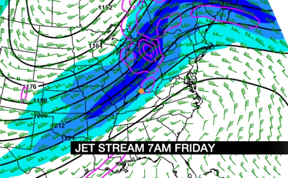
Because instability is often limited this time of year, it is important to see where the jet stream will located when assessing the potential for severe weather. Friday morning’s NAM model – along with most computer models – have the jet stream (pictured below in blue) positioned to our north tomorrow morning, but in a part of the jet stream where lift is favored (highlighted with pink near Cincinnati, which is an orange dot):
The strongest cells in the Tri-State may not produce lightning. Even clusters of rain Friday morning may produce strong or severe winds. While damaging straight-line wind is the main severe weather threat tomorrow, the tornado (weak and short-lived) threat is in play. Again, the overall threat for severe weather is LOW:
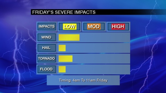
Notice that 4am to 11am Friday is the severe weather window. Future radar data suggest a line or lines of rain and storms will be materializing along and west of I-75 around 4am:

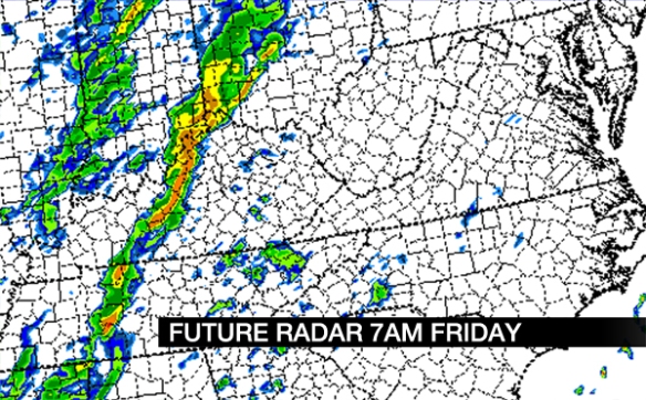
Lines of rain and storms will be sweeping through the heart of the Tri-State nearing 7am. Notice models trying to create bowing segments in the Ohio Valley tomorrow morning; this suggests the possibility for damaging wind in the strongest cells:
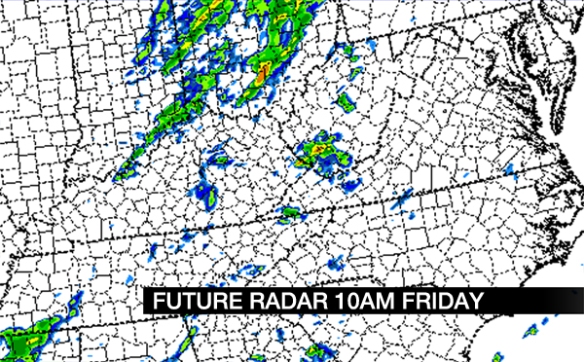
The threat for severe storms will decrease gradually Friday morning. Notice rain and storms gradually moving east of Cincinnati and weakening by 10am:
As always, have your NOAA weather radio on and programmed correctly; you might check this before you go to bed tonight. Even if storms don’t become strong or severe, soaking rain and wet roads are likely for Friday morning’s commute.