
Scattered showers are forecast through the lunch hour. Regional radar shows rain showers moving from west to east through the Tri-State:
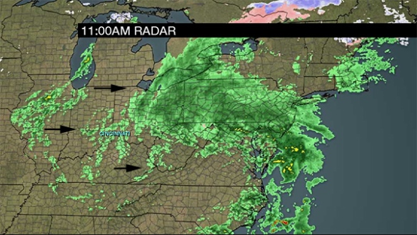
Notice the break in showers over west-central Indiana. That break is over the Tri-State by mid-afternoon, but the area of rain showers in Illinois will overspread the Tri-State late in the business day and this evening. The amount of lift in the atmosphere is increasing to the west, so plan for more showers later today and tonight after a brief break this afternoon.
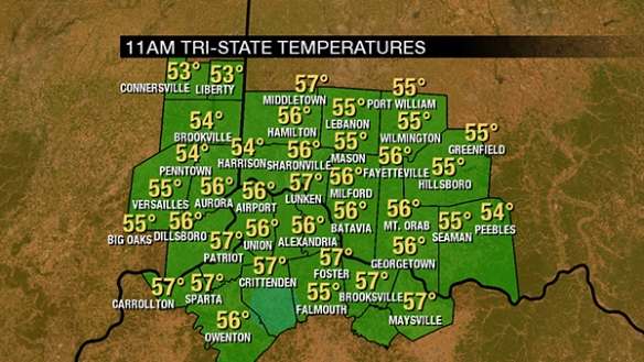
It’s warm outside! As of 11am, temperatures are in the 50s:
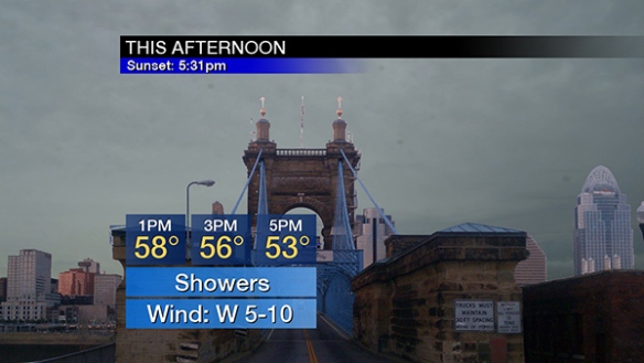
Temperatures will be gradually falling through the 50s this afternoon with showers favored early and late:
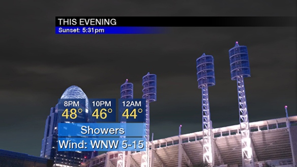
Showers will continue this evening as temperatures fall through the 40s:
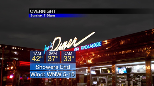
Showers will diminish late tonight, briefly mixing with flurries, especially northwest of Cincinnati:
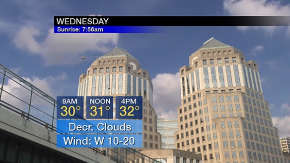
Notice the quicker fall in temperatures late tonight compared to this evening! We’ll start Wednesday in the upper 20s and low 30s. Little if any warm up is forecast Wednesday, even with decreasing clouds:
Wednesday will be a much colder and breezy day. The next wave of precipitation (Thursday) will be in the form of snow showers. Models are getting more aggressive with the strength of this wave, so up to 1″ of snow is forecast Thursday:
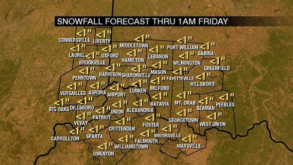
Notice that no Tri-State community is favored for more or less snow. Snow showers implies snow that starts and stops. Here is a summary of late week impacts:
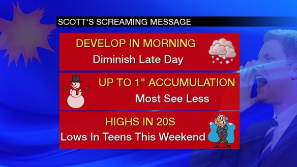
Snow showers will increase in coverage Thursday morning, decrease in coverage late Thursday, and cold air will plunge into the Ohio Valley behind this wave. Lows will be in the low to mid teens and highs will be in the mid to upper 20s Friday through Sunday.
Snow squalls are unlikely Thursday, but there will be drops in visiblity underneath snow showers.