A winter storm is still forecast to affect the Ohio, Tennessee, and Mississippi Valley Tuesday through Thursday, but there are large discrepancies on the exact timing, positioning, and strength of this system. This is not unusual this far out. We are entering a time period where longer range models will wobble from one solution to the next and shorter range models are just now getting up to speed on where this area of low pressure will go.
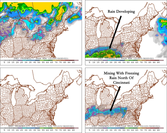
In the shorter term, there is fairly high confidence that light rain and freezing rain will develop in the Tri-State tonight. The latest SREF model run shows rain for most at 1am tonight and the potential for freezing rain north of the Ohio River:
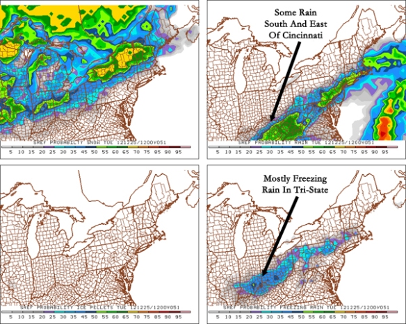
As temperatures go above freezing tomorrow morning and afternoon, the threat for freezing rain will diminish. Rain, however, will begin mixing with freezing rain and snow Monday evening and early Tuesday. Notice the latest SREF model showing a blend of freezing rain, rain, and snow by 7am Tuesday morning:
While there is no strong agreement in the latest round of model data on the potential for ice accumulation Monday night and early Tuesday, this signal from the SREF model is telling. While few will be going to work Christmas Day, the threat for ice accumulation Monday night and Tuesday morning needs to be watched carefully.
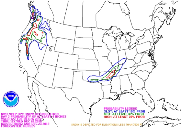
The strong model agreement regarding accumulating snow Tuesday night through Thursday is not as strong today. Both the early morning GFS and NAM model give the Cincinnati area little to no snow, but the ECMWF model remains consistent with it’s solution of heavy snow for much of Ohio, Kentucky, and Indiana. The latest outlook from NOAA’s Hydrometeorological Prediction Center shows the potential for 4″+ of snow from 7am Tuesday to 7am Wednesday west of Cincinnati:
Given the uncertainty in the latest model runs, no snowfall amounts will be released today, and totals and may not be released tomorrow. Releasing forecast snowfall totals too early just leads to empty promises; I would rather wait and issue a forecast with confidence than release it too early and mislead people.


Good work, Scott. Merry Christmas.