Have you ever heard of “cooling stack enhanced snow?” Odds are you probably haven’t, but it was the reason behind light snow bands in the Tri-State this morning.
When “lake effect snow” or “lake enhanced snow” falls in the Ohio Valley, cold air is passing over a relatively warm lake, such as Lake Michigan. In the Tri-State, bodies of water are very small, and lake effect snow bands rarely form downwind of these bodies of water.
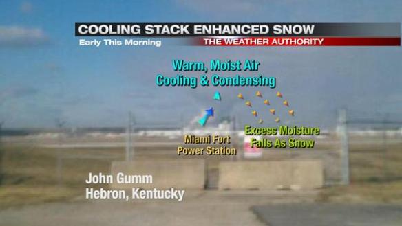
While we did not have “lake effect snow” or “lake enhanced snow,” many saw “cooling stack enhanced snow.” Cooling towers at Tri-State power plants often release warm, moisture-laden air into the atmosphere. Because their is a large temperature difference between this air and the air surrounding it, the air from the cooling stack cools and condenses rapidly, forming a cloud. Excess moisture falls from the cloud as light snow.
This process happened early this morning downwind of the Miami Fort Power Station in northern Boone County near the Cincinnati/Northern Kentucky International Airport:
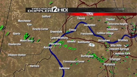
At 8:30 this morning, you could see bands of snow on our live radar over northern Kentucky and downwind of the Miami Fort Station:
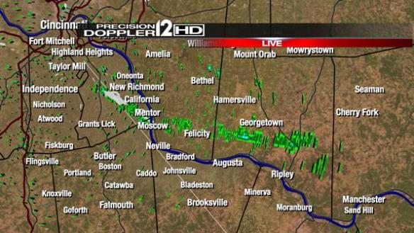
You could also see a narrow band of light snow on radar east-southeast of the Zimmer Power Plan in Moscow at 8:30 this morning:
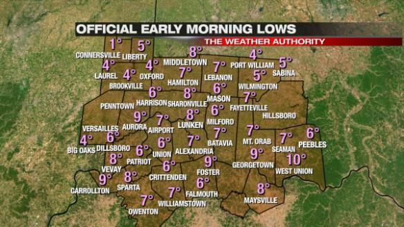
We don’t know how warm the air was coming out of the cooling stack this morning, confidence is high that the temperature difference between this air and the air surrounding it was large. Early morning lows were reached around the time these bands were forming and producing light snow, and it was cold: