The next 24 hours will be fairly quiet in the Ohio Valley, but a threat for storms continues in the Ohio Valley Tuesday night and early Wednesday. Severe weather is not a guarantee, but the threat for severe weather has increased since yesterday.
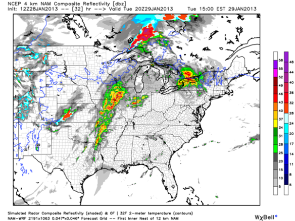
This morning’s WRF model suggests clusters of thunderstorms will be northwest of the Tri-State for mid-afternoon Tuesday:
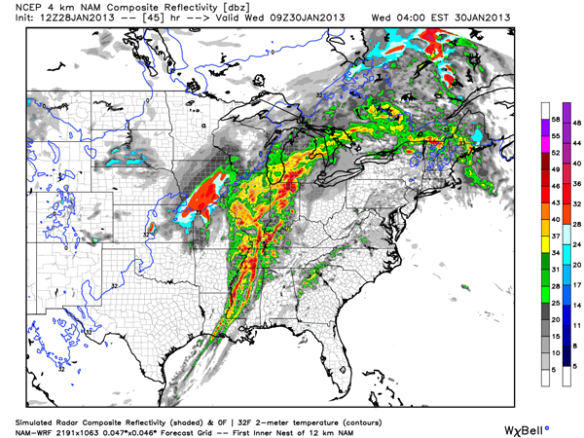
Also note the line of showers and thunderstorms organizing in the Mississippi Valley tomorrow afternoon. This morning’s WRF model has that line of showers and thunderstorms (and perhaps some individual cells ahead of the line) moving into the western half of the Tri-State by 4am Wednesday:
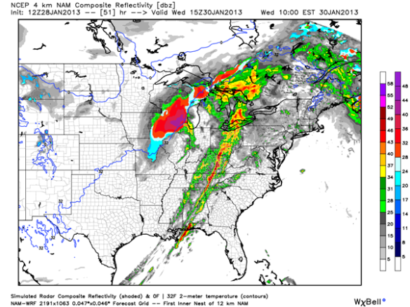
The WRF model has this line of showers and thunderstorms moving east of Cincinnati by 10am Wednesday:
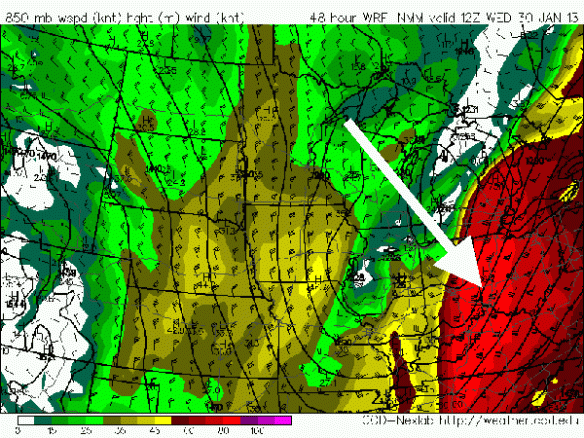
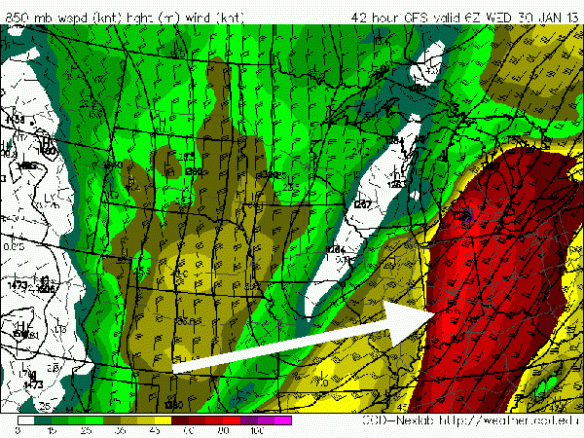
As I mentioned in yesterday’s blog post, damaging winds will be the main severe weather threat early Wednesday morning. One indication of this is the strength of the wind 5,000 feet above the ground; this morning’s NAM model shows 60-80 knot (70-95mph) winds 5,000 feet above the Tri-State at 7am Wednesday:
This morning’s GFS model has winds about as strong at 1am Wednesday in the Ohio Valley:
If these winds can be transferred down to the ground, storms may produce damage.
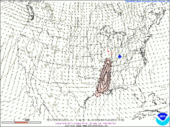
When it comes to wind shear, the speed shear (the change in wind speeds going away from the ground) is impressive but the directional shear (often needed for tornadoes and defined as the change in the wind direction going away from the ground) is not as impressive. For this reason, the latest SREF model from the Storm Prediction Center has the best tornado support along the Mississippi River at 1am Wednesday (Cincinnati is the blue dot):
Summary
Damaging straight-line winds will be the main concern with any strong storms in the area early Wednesday morning. Storms will likely arrive in the Tri-State in a weakening mode, but storms may still be strong or even severe. Large hail and heavy rain are secondary threats with the strongest storms, and the tornado threat is the lowest threat. Be prepared for heavy rain and gusty winds during Wednesday morning’s commute.

