
After a night and early morning with ice, low pressure is moving east, and high pressure is moving in from the west. This weekend will be reasonably warm and quiet, but cold air will pour in from Canada by the middle part of next week.
There are some differences among the newest model data on how cold we will get next week. This morning’s GFS model suggests temperatures will be 5-15° below average Wednesday afternoon (shades of blue and green):
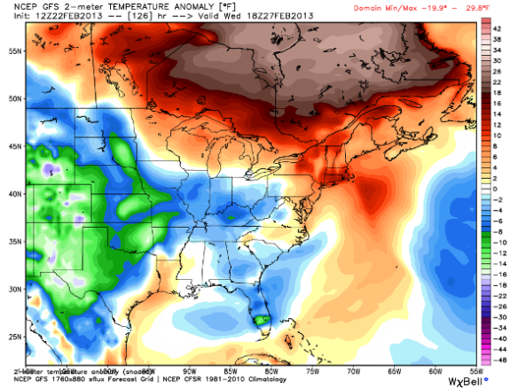
I agree with this model forecast. We’ll likely have high temperatures in the mid 30s Wednesday. When you look about 5,000 feet above the ground next Saturday morning, you’ll find temperatures well below average in the Ohio, Mississippi, and Tennessee Valley:
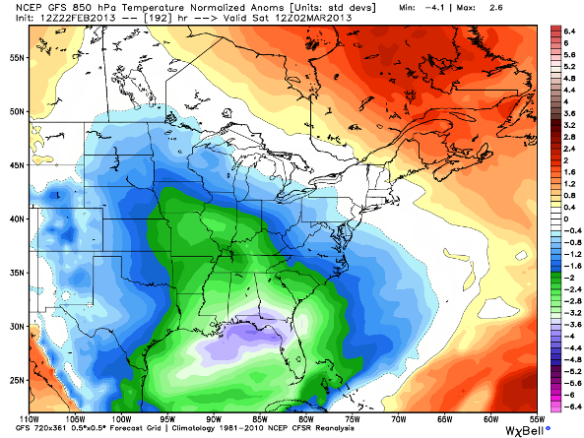
If this model forecast verifies, temperatures may reach into the low to mid 30s in northern Florida early next weekend. This is a longer range forecast (with plenty of room for uncertainty), but it bears watching. Watch out, citrus crops!
This morning’s ECMWF model is also aggressive with a plunge of arctic air sweeping in behind Tuesday morning’s cold front. Notice the surge in warmth 5,000 above the ground Monday morning per the latest ECMWF model run (red and purple colors):
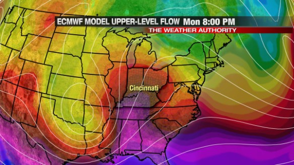
I expect temperatures to reach to near 50° Monday afternoon before rain moves in from the west. We’ll drop into the 30s Tuesday morning and stay in the 30s Tuesday afternoon. The ECMWF model has plenty of cold air aloft at 8am Wednesday morning (yellow and green colors):
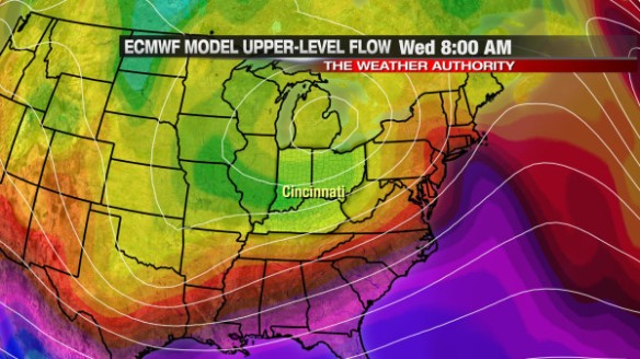
We’ll be in the 30s all day Wednesday, and the 20s and 30s all day Thursday. Like the GFS, this morning’s ECMWF model suggests even colder air may drop into the Great Lakes and Ohio Valley by next Friday (green and aqua colors):
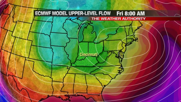
If this model forecast verifies, we’ll start next Friday in the mid 20s and finish Friday near freezing.
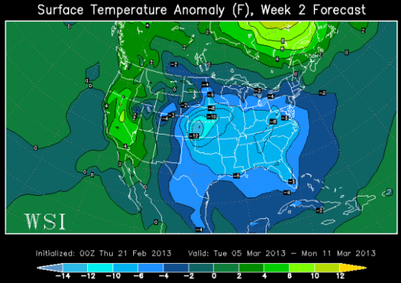
Next week may be the start of a prolonged colder than average period. The latest ECMWF Weekly model released yesterday suggests the first full week of March will be colder than average in the Ohio Valley:
The ECMWF weekly also suggests that temperatures will be closer to average in the following week:
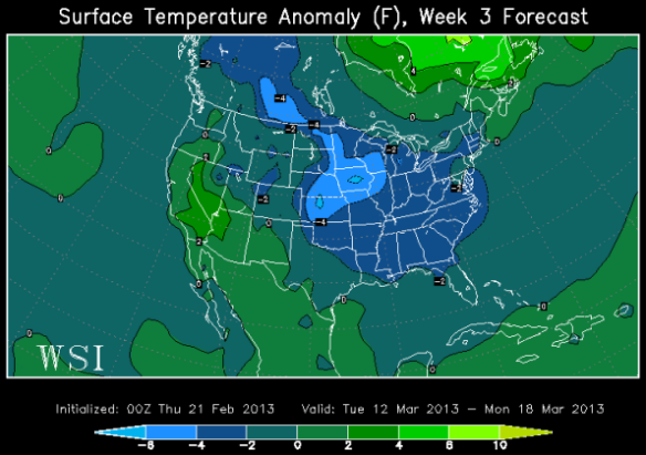
Of course, this is just one long range model and is not guaranteed to happen. While the latest ECMWF Weekly suggests much of March will be colder than average, I expect a wide range in high and low temperatures averaging out below average.
Enjoy a quiet, brighter weekend!