
New long range data has come into the weather center over the last week, and it looks like any warm-ups for the rest of March will be short-lived.
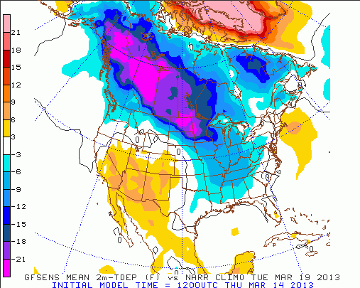
This morning’s GFS model is very similar to the last several runs before it, keeping colder than average temperatures around through the weekend, next week, and the week after next. While there will be some warmth into the start of this weekend, this morning’s GFS model has colder than average air (purple and blue colors) over much of the Midwest and Ohio Valley by next Tuesday:
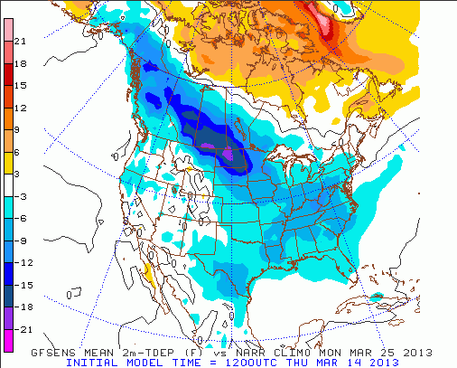
The GFS model also suggests that cold air sticks around into late March, including for Monday, March 25th:
Northwest flow and a persistent snowpack in southern Canada means reenforcing shots of cold air will keep coming for the second half of March.
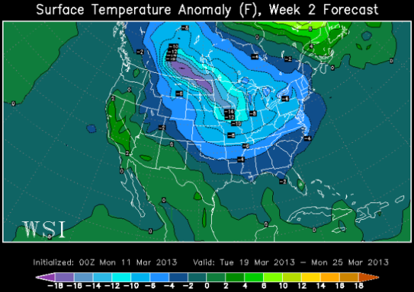
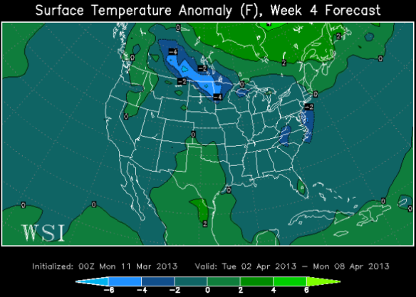
A new ECMWF Weekly model run came in this afternoon. Like the GFS, it suggests below average temperatures will dominate for late March and early April. This afternoon’s ECMWF Weekly model says temperatures will be below average (blue colors) from this past Tuesday through next Monday:

The model also says temperatures will be below average in the Ohio Valley from next Monday through March 25th:
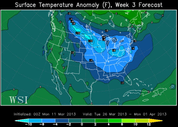
…and from March 26th from April 1st:
…and from April 2nd to April 8th (although not as cold as previous weeks):
The theme is clear: cold air will be a clear winner over warmth for the next few months. It is still too soon to make an outlook on the summer.