The active weather pattern we have been stuck in for the last several days will not be going away anytime soon. Several disturbances are forecast to move through the Ohio Valley between now and next weekend. Some will be weak, while others will have punch. Some disturbances have little uncertainty surrounding them, while others are very uncertain.
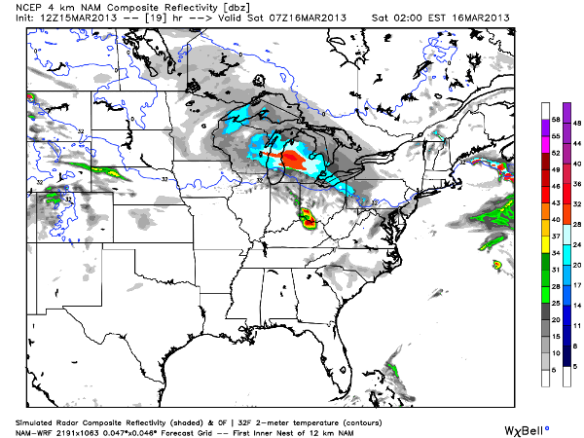
While much of the evening will just be cloudy to mostly cloudy, showers and isolated thunderstorms will develop nearing midnight. A rapidly developing area of low pressure approaching from the west tonight will likely spark clusters of showers and thunderstorms later tonight. This morning’s WRF model has rain and thunderstorms in our area by 2am Saturday:
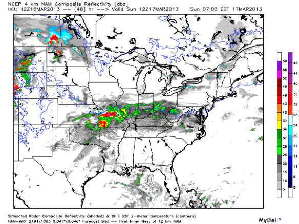
Given the amount of cold air aloft, small hail and brief gusty winds will be possible with any thunderstorms that form. Confidence is high that showers and thunderstorms will diminish Saturday morning, and much of Saturday will be cloudy to mostly cloudy. Precipitation, however, is likely to return by 8am Sunday morning, as this morning’s WRF model shows:
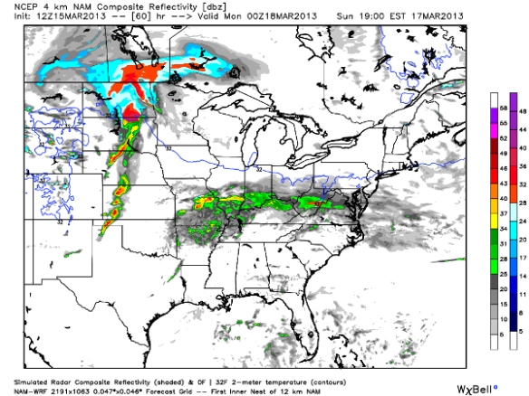
If you look closely, the model has the 32° isotherm/line in our area when precipitation is falling. With temperatures at and above the ground near freezing early, snow may mix in with rain in the morning. By afternoon, we will have just rain in our area with temperatures approaching 40°. This morning’s WRF model has rain in our area Sunday evening as well:
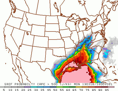
Greater uncertainty in the forecast comes for Monday as yet another area of low pressure sweeps across the Plains. Given modest instability, there will be a risk for thunderstorms Monday morning, afternoon, and night. There is still some uncertainty on how strong thunderstorms will be Monday and Monday night. The Short Range Ensemble Model suggests the best instability in our area will be in the early afternoon and focused over northern Kentucky:
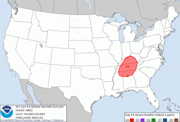
Given modest instability coupled with the strength and positioning of low-level moisture, upper-level energy, and wind shear, the Storm Prediction Center has placed sections of the Ohio and Tennessee Valley under a risk for severe storms Monday morning, afternoon, and night:
Two weaker disturbance passing through the Tri-State will give us a chance for flurries Tuesday and Wednesday morning.
More energy will move in late next week, bringing rain and perhaps snow showers to the Ohio Valley later next week. The timing and strength of this system is very uncertain.

