
A strong cold front will sweep through the heart of the U.S. and the Ohio Valley tonight, Wednesday, and Thursday. There is still uncertainty about the exact timing and strength of storms in the Tri-State late Wednesday night through Thursday evening, but the threat for severe weather will be higher southwest, west, and south of Cincinnati through Thursday night.
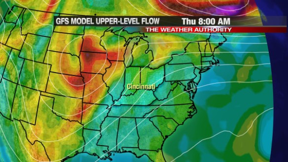
In addition to the cold front, the driving force behind the severe weather threat Thursday will be a large upper-level disturbance moving in from the west. This morning’s GFS model has that upper-level disturbance (in orange and red) to our west early Thursday morning:
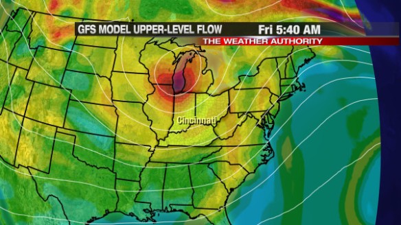
This disturbance is a lifting mechanism, so showers and thunderstorms will be likely ahead of it. This morning’s GFS model has this upper-level energy to our north and east by Friday morning, as the cold front pushes east:
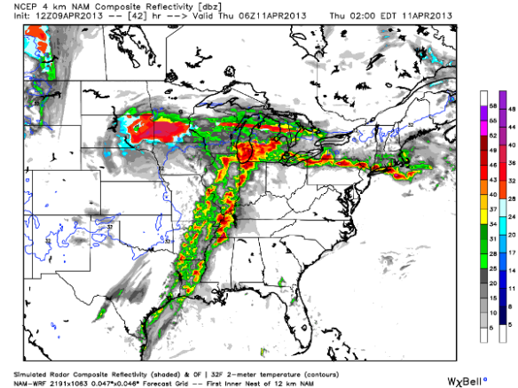
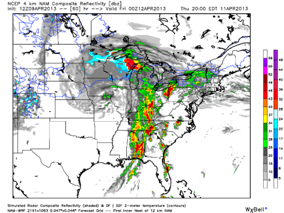
The future radar product from this morning’s WRF model suggest showers and thunderstorms will be staying to our north, northwest, and west at 2am Thursday:
By 8am Thursday, the WRF morning suggests showers and thunderstorms will be approaching the Tri-State from the west:
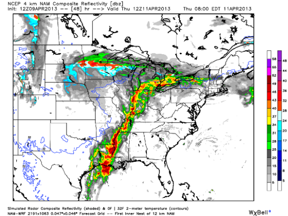
In this particular radar snapshot, more green and yellow colors over orange and red colors suggests showers and storms will arrive in a weakening mode as temperatures drop overnight.
The severe weather threat, however, will continue through Thursday early evening. The cold front will slow down as it moves through the Tri-State Thursday, so strong and severe storms remains a possibility Thursday afternoon and early evening. This morning’s WRF model shows showers and thunderstorms energizing – especially east of Cincinnati – late Thursday afternoon and early evening:
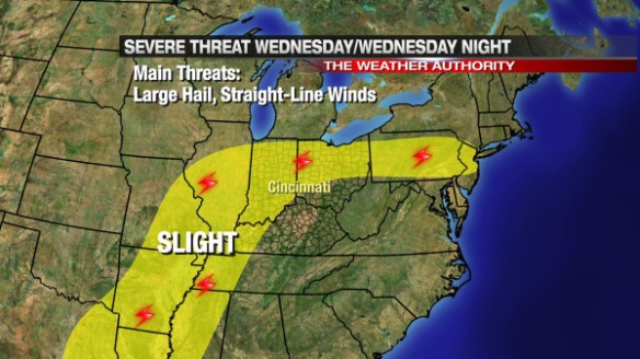
When you break down the severe weather threat by day, the Storm Prediction Center has placed areas northwest of Cincinnati under a SLIGHT risk of severe storms Wednesday night (through 8am Thursday):
SPC has southern, southeastern, and eastern parts of the Tri-State under a SLIGHT risk for severe storms from 8am Thursday through Thursday night:
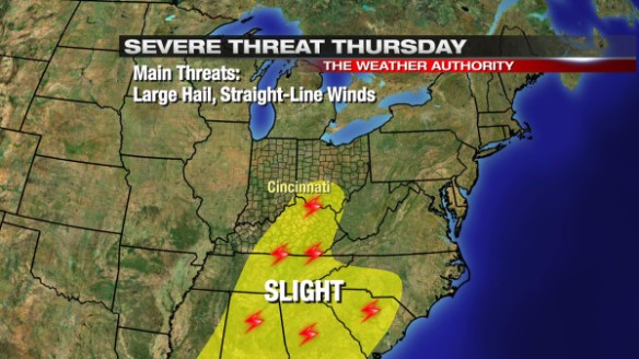
Damaging straight-line winds and large hail will be the main severe weather threats Wednesday night and Thursday. The tornado threat is in play, but it is the lowest of the main three severe weather threat.