
Today is “Day 1” of a rather active period of weather. While every day this week will not be a washout, there are significant chances for rain each day this week. April is known for showers and thunderstorms, and this week will be no exception.
Satellite and radar imagery reveals thick clouds over the Ohio Valley and showers northwest of Cincinnati as of 4:25pm:
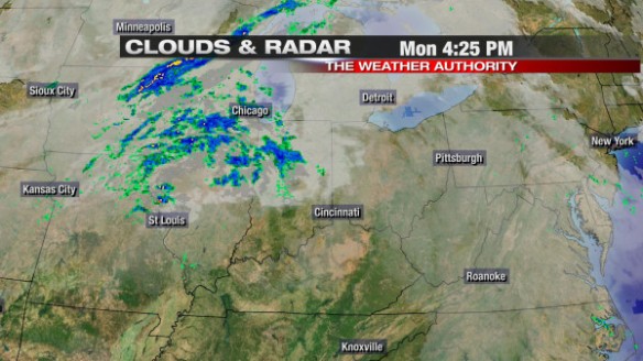
While some in Fayette and Union County may see a quick, passing showers through 8pm, nearly all of the Tri-State will be dry this evening and most of the overnight. By late tonight and early tomorrow, the cold front to our west (the lifting mechanism that helped to produce showers today in the Ohio Valley) will be nearing the Tri-State, allowing for showers and isolated thunderstorms to develop in the Cincinnati early tomorrow morning.
Tuesday will be mostly cloudy with rain and scattered thunderstorms. Given dewpoints in the 60s and temperatures gradually rising through the 60s and 70s tomorrow, strong and severe storms are possible. The Storm Prediction Center has placed most of the Tri-State under a SLIGHT risk for severe storms tomorrow:
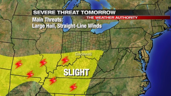
Based on the latest model data, large hail and damaging straight-line winds will be the main severe weather threats Tuesday. The tornado threat – for now – is low.
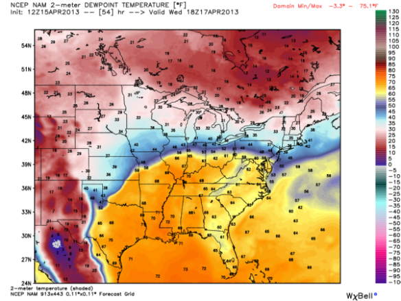
Rain and thunderstorms will be more scattered Wednesday, but ample low-level moisture will support a threat for heavy rain with the strongest showers and thunderstorms. This morning’s WRF models suggests dewpoints will be in the low to mid 60s (yellow and orange colors) Wednesday afternoon:
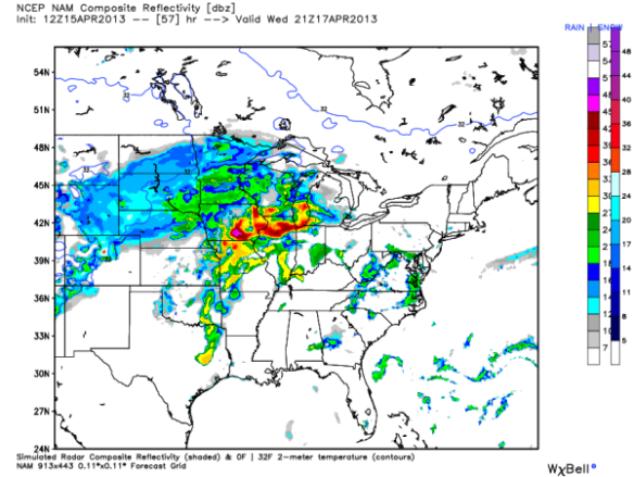
This morning’s WRF model suggests showers and thunderstorms will affect most of the Ohio Valley, Mississippi Valley, and the Great Lakes by late Wednesday afternoon (largely in part to this surge of low-level moisture):
Thursday will be very similar to Wednesday. This morning’s WRF models suggests dewpoints will be in the low to mid 60s (yellow and orange) Thursday afternoon:
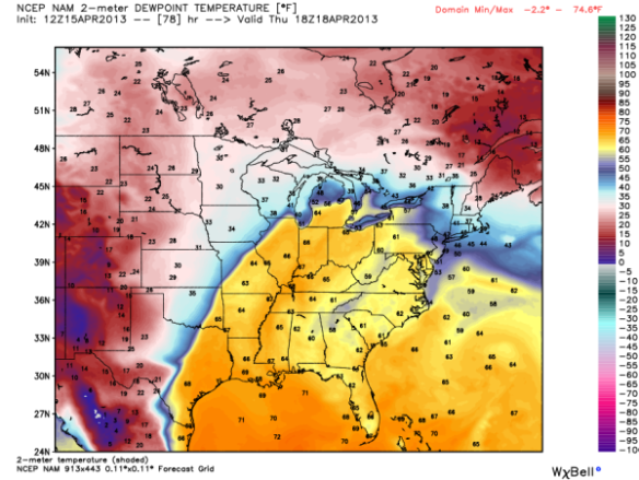
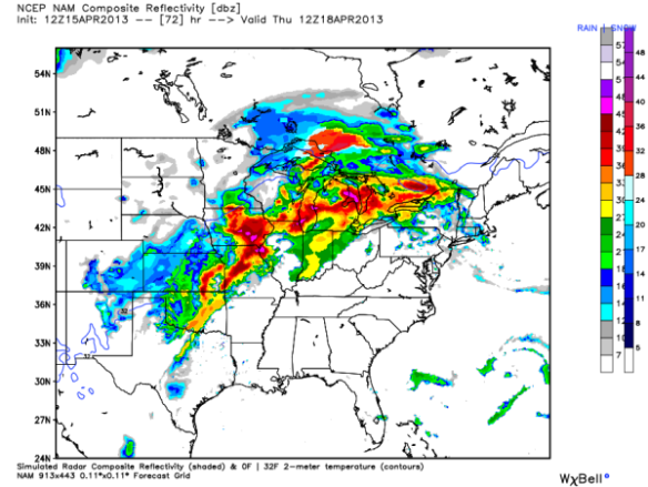
As a result of this low-level moisture, the same WRF model suggest showers and thunderstorms will be widespread to our north and west at 8am Thursday morning; the coverage and intensity of showers and storms will continue building into the afternoon and evening:
In addition to a stalled out front in the area, ample low-level moisture, and warm air in the region, a large upper-level disturbance will approach us Wednesday, Thursday, and early Friday. This morning’s GFS model suggest this disturbance will take on a “bowling ball” shape by Friday morning:
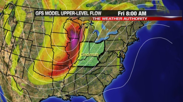
This “bowling ball” shape – especially this time of the year – is usually a catalyst for severe storms if other conditions are present.
The primary focus for strong and severe storms this week will be Thursday night and Friday ahead of this disturbance and with a strong cold front coming through. It is too early to discuss specifics on severe weather threats and timing.