
Only scattered showers are forecast through mid-evening, but the threat for rain will build later tonight. The threat for thunderstorms is barely there; most will just see rain – heavy at times – after midnight.
Clouds will stay thick through the night. The most recent satellite and radar data snapshot shows scattered showers in our area now, and plenty of rain along a cold front to our west.
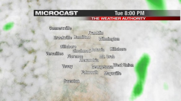
This morning’s Microcast run does a nice job with the timing and intensity of rain tonight and tomorrow. Microcast suggests widely scattered showers will be around at 8pm tonight:
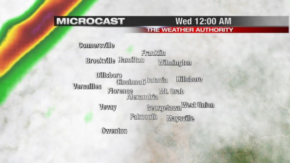
By midnight, Microcast keeps the best chance for rain west of Cincinnati:
Microcast (and other models all) suggest there will be plenty of rain around overnight and early tomorrow morning; be prepared for a wet morning commute:
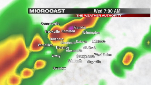
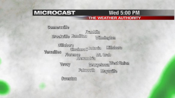
Notice there will be some pockets of moderate to heavy rain early Wednesday morning. Ponding of water on the roads is the main concern for this event. The risk of severe thunderstorms and flooding is low at this point. By 5pm Wednesday, the widespread rain will be long gone and clouds will break some, as Microcast shows:
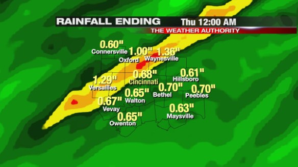
How much rain will we get? There are some disagreements amongst the latest round of model data on how much rain will accumulating, but most models – including Microcast – suggests most will see 1/4″ to 3/4″ of rain through tomorrow afternoon. Some may see 3/4″ to 1 1/4″ of rain:
Colder air will sweep in behind this cold front. Light winds and temperatures in the mid 30s Thursday morning and Friday morning suggests there may be some areas of frost before the sun comes up.