
An upper-level area of low pressure continues to spin over the Tennessee Valley at this hour, but it will slowly push east nearing mid-week. This upper-level low can clearly be seen as the swirl in 7:30pm water vapor satellite imagery (sampling moisture 15,000 to 30,000 feet above the ground):
Ahead of this upper-level low is a large plume of low-level moisture, giving most in the Tri-State soaking rain now. Here are some 24-hour rainfall totals (8pm Saturday to 8pm Sunday) in the Tri-State:
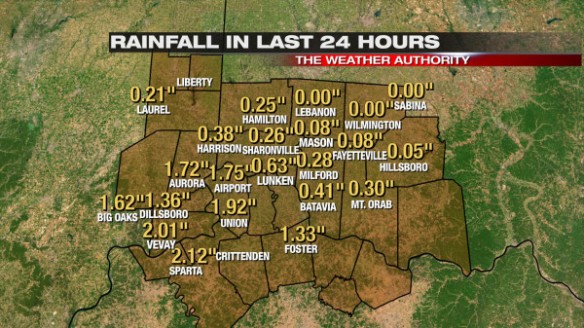
The daily rainfall record for Cincinnati today (May 5th) has been already been broken. 1.72″ of rain fell through 8pm today at the Cincinnati/Northern Kentucky International Airport; the old daily precipitation record for this date was 1.67″, set in 1882.
Note many in the far northeastern part of the Tri-State have seen little or no rain, while some southwest of downtown Cincinnati have picked up more than 2″ of rain in the last day.
This morning’s Microcast run does a nice job with the timing of precipitation through Monday night. Microcast suggests light, moderate, and even some pockets of heavy rain will be around at midnight Monday:

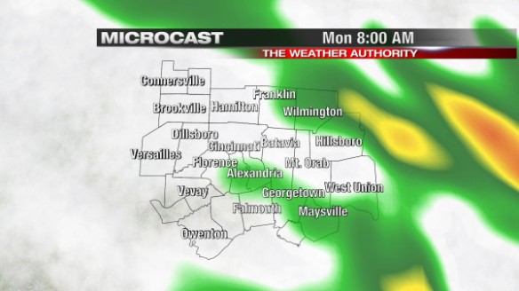
Microcast suggests the coverage and intensity of rain will drop some overnight, but there will still be clusters of rain in the Tri-State at 8am Monday:
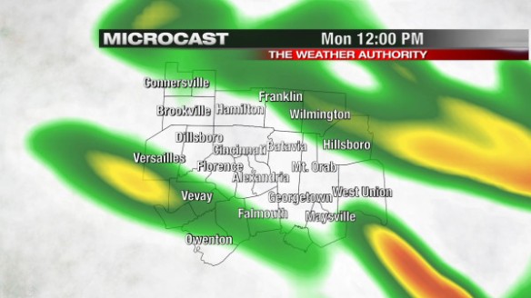
As temperatures rise through the 50s Monday morning, the coverage of rain will increase. Microcast suggests (and so do I!) you should plan for showers in and around your neighborhood at lunchtime tomorrow:
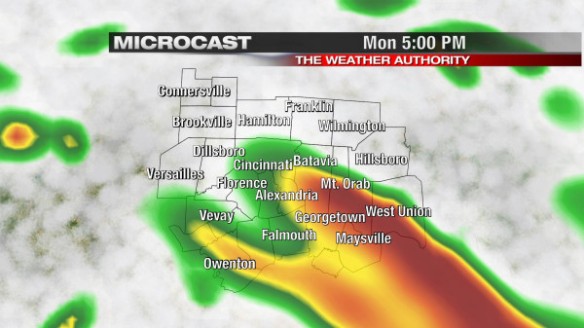
Microcast still has rain in the Tri-State at 5pm tomorrow, but I don’t expect it to be as widespread in Cincinnati as it was this afternoon:
Rain will be more scattered Monday night and Tuesday as this upper-level low slowly pushes east.
So when will the rain be done for a while? This morning’s GFS model suggests this upper-level area of low pressure (yellow, orange, and red colors) will to our southeast by early Tuesday morning:
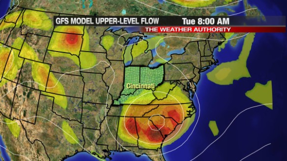
Energy rotating around that low pressure center (bright colors) will trigger scattered showers in our area Tuesday. By Thursday morning, the GFS model has this disturbance to our east:
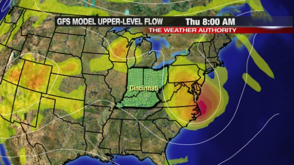
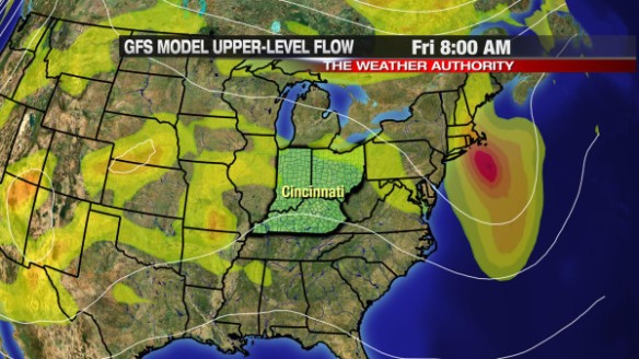
All of the energy with that system will be focused to our east by then, so Wednesday and early Thursday look quiet. The GFS model, however, has more energy (yellow and orange colors) to our west by Friday morning, meaning chances for showers and thunderstorms will return late in the work week:
Wednesday looks to be our only break from this active pattern this week! Longer-range forecast guidance suggests early next week will be quiet but cool.