
The threat for severe storms is still very much in play Wednesday night for the Tri-State; however, that threat has dropped some in the last 24 hours.
The Storm Prediction Center has placed parts of southeastern Indiana and a small part of northern Kentucky in a marginal risk for severe storms Wednesday night:
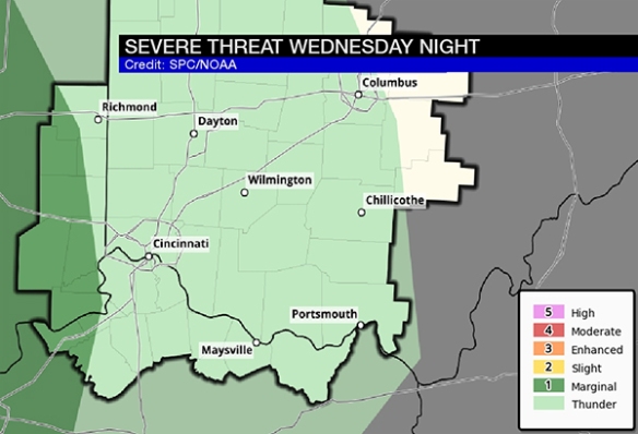
As of Monday night, nearly the entire Tri-State was in a slight to marginal risk for severe storms. The map above shows the risk for damaging storms has dropped, but strong storms and heavy rain still remain a possibility.
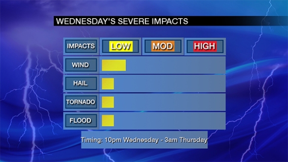
The threat for severe storms in the Tri-State will center between 10pm Wednesday and 3am Thursday. Damaging straight-line wind is the main threat, but it is not the only threat:
One computer forecast model shows a line or lines of rain and storms developing in the Mississippi Valley Wednesday night. Some discrete, rotating cells are possible over Missouri and Illinois tomorrow, as this model suggests:
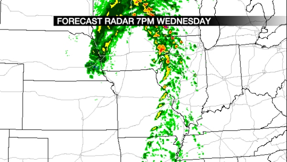
This same computer model shows the line of rain and storms to our west early Wednesday evening weakening by the time they get close to Cincinnati:
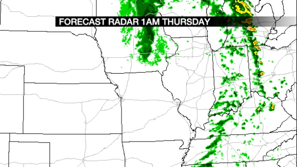
While I expect the line of rain and storms to be better organized and less broken than this model suggests, there is a clear indication from the model that storms will weaken traveling east through the Ohio Valley Wednesday night.
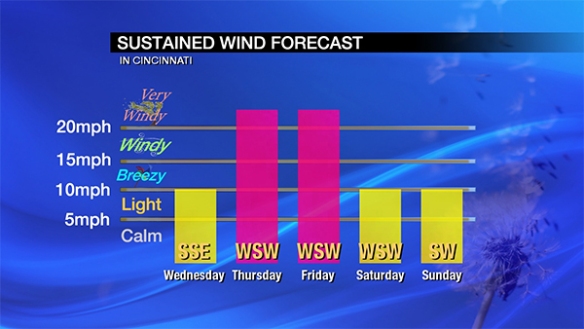
One thing that has not changed is my thinking on wind following Wednesday night’s storms. The sustained wind Thursday and Friday in Cincinnati will be between 15 and 30mph with gusts up to 45mph possible:
Winds will relax by this weekend. Please stay weather aware Wednesday night as storms move through the Tri-State. Even after storms pass, the wind will remain strong Thursday and Friday with a strong area of low pressure nearby.