Wednesday night will be one of those times to be alert for thunderstorms and strong wind. Today is only Monday, so there is roughly 48 hours to adjust the forecast.
There is high confidence that the best threat for severe storms during this event will be to our west in the Mississippi Valley. The tornado, damaging straight-line wind, flooding, and hail threat all converge on Missouri, Illinois, western Kentucky, and northeast Arkansas. In the Ohio Valley the threat for severe weather will be maximized late Wednesday evening and in the very early morning hours of Thursday. Storms that develop to our west Wednesday afternoon will move east towards the Tri-State at 45 to 60mph; in simple terms, storms in the Ohio Valley Wednesday night will be fast movers.
There is moderate confidence that the threat for severe storms will gradually drop as storms that develop in the Mississippi Valley move east Wednesday night. Because there will be gradual decrease in the intensity of storms, severe storms remain a possibility in the Ohio Valley – especially west of I-75 – Wednesday night.
There is low confidence in the exact strength and timing of storms Wednesday night. While there is computer forecast model agreement at this time, models may give us adjustments on timing and how strong storms will be later this week.
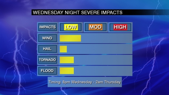
Heavy rain and strong to severe wind are the main severe weather threats in the Tri-State Wednesday night:
Note the most likely time for strong or severe storms in the Tri-State is from mid-evening Wednesday into the early overnight Thursday. The tornado threat is non-zero, as is the threat for flooding. The hail threat is very low at this time.
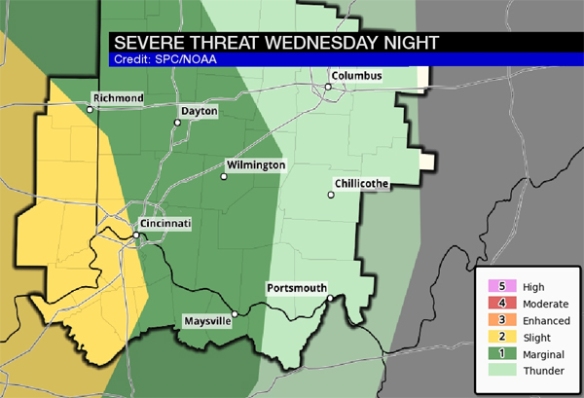
The Storm Prediction Center has placed the Tri-State in a marginal to slight risk for storms Wednesday night, with the highest threat for severe storms being west of Cincinnati:
With storms forecast to move from west to east Wednesday night, this map suggests storms will weaken as they sweep through the Tri-State.
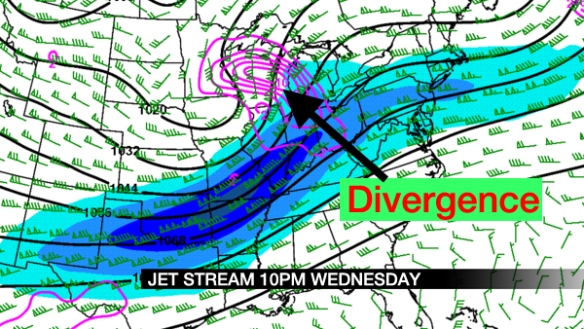
The position of the jet stream is very important in severe weather forecasting this time of year. In the map below, the jet stream is in blue, and faster winds are in the dark blue color. Divergence aloft – in purple where air is rising – is centered to our northwest Wednesday night:
Because the best lift from the jet stream will be to our northwest, this will limit but not prevent the threat for strong storms. Note weaker divergence over Cincinnati Wednesday night, so at least some upper-level support is there.
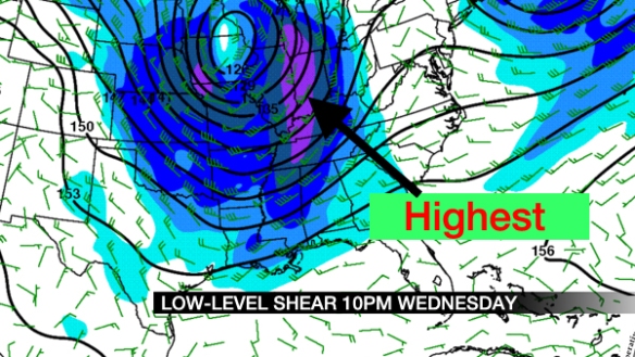
Low-level shear – or the change of the speed and direction of the wind with increasing altitude – is also important for severe storm forecasts. Notice an abundance of speed shear over the Tri-State Wednesday night:
More shear tends to support better organization to storms. In this case, there is plenty of speed shear but not a lot of directional shear; this suggests the tornado threat is limited, but damaging straight-line wind is a concern.
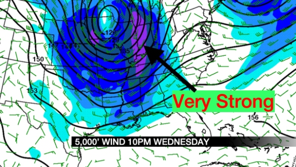
The wind about 5,000 feet above the ground Wednesday night will be very strong (about 80mph! in purple):
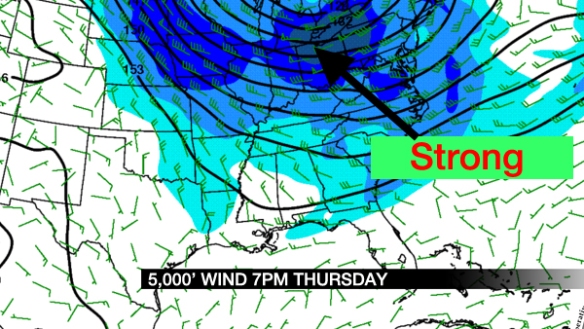
While not ALL of this wind will be transferred to the ground, this is a very strong wind. For the math buffs, these wind speeds are about 2 to 3 standard deviations above average. The threat storms will end Wednesday night, but strong wind is forecast Thursday and Friday (sustained between 15 and 30mph with higher gusts). Note the ribbon of strong wind focused to our north Thursday evening:
Wind speeds will drop Saturday, and the wind will be light Sunday.
Be prepared for storms and strong wind Wednesday night! Even if storms don’t cause damage, winds may be strong enough to cause power outages.

