A Tornado WATCH or a Severe Thunderstorm WATCH may be issued for most of northern Kentucky and southwestern Ohio shortly.
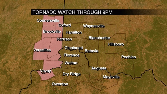
Carroll County and all of southeastern Indiana are under a Tornado Watch through 9pm:
Additional watches and warnings may be posted for the Tri-State later this afternoon and this evening. Be alert!
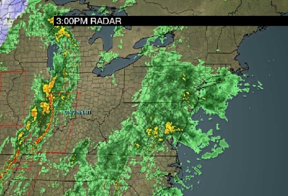
The radar composite as of 3pm shows a bowing line of storms to our west. These storms are moving east at roughly 45mph and are quite capable of producing damaging straight-line wind in excess of 60mph:
Additional round of rain and storms are likely tonight, but the round approaching from the west is likely to be the main event. It will zap a lot of the instability available for storms this evening.
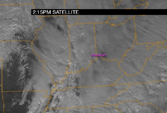
The visible satellite snapshot as of 2:15pm shows breaks in the cloud both ahead of the line of storms around Louisville and also behind it:
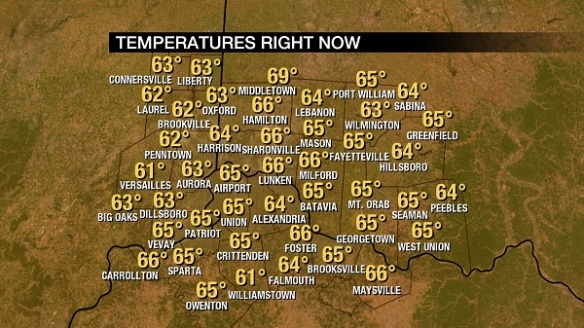
Breaks in the clouds will support to an increase in instability and stronger storms. Temperatures have been slow to rise today due to a cloudy sky, but strong southerly flow has pushed temperatures into the mid 60s for most:
There is still plenty of time for the record high today in Cincinnati of 66° set in 1933 to be broken or tied.
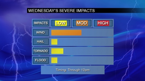
The main severe weather threat through tonight continues to be damaging straight-line wind, but tornadoes are also a secondary threat:
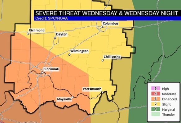
Most of the Tri-State is still in an ENHANCED risk for severe storms through tonight, with the highest threat being southwest of Cincinnati:
You are encouraged to have multiple ways of getting warnings and watch information, including from a NOAA weather radio!

