
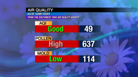
Feeling stuffy? The pollen count is high as of 10am this morning…
Breezy and windy days tend to have an elevated pollen count. It will probably be high tomorrow.
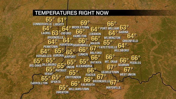
It’s a warm windy day in the Tri-State. As of 11am, temperatures are already in the mid 60s:
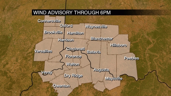
The wind will be sustained out of the southwest this afternoon between 15 and 30mph. Gusts may be as high as 45mph to 50mph in some Tri-State communities today. A Wind Advisory is in effect through 6pm for the entire Tri-State:
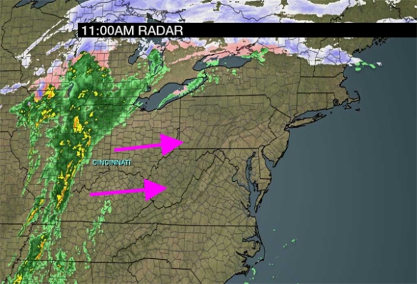
Radar shows a well-defined line of rain and storms approaching from the west:
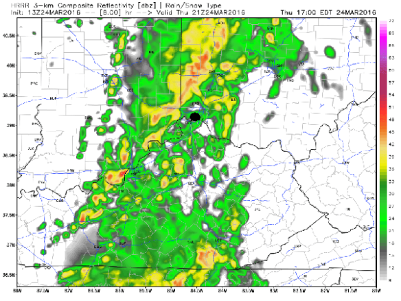
Rain and storms will increase through mid-afternoon. Rain and storms will decrease early this evening. Here’s one one model thinks the radar will look like at 5pm:
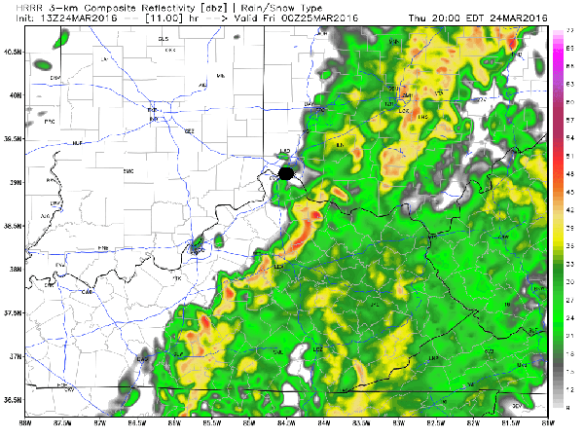
While rain and storms will be moving through the Tri-State, I believe this model is too slow. The threat for strong storms will be decreasing around and after 5pm. Here’s what the same model thinks the radar will look like at 8pm tonight:
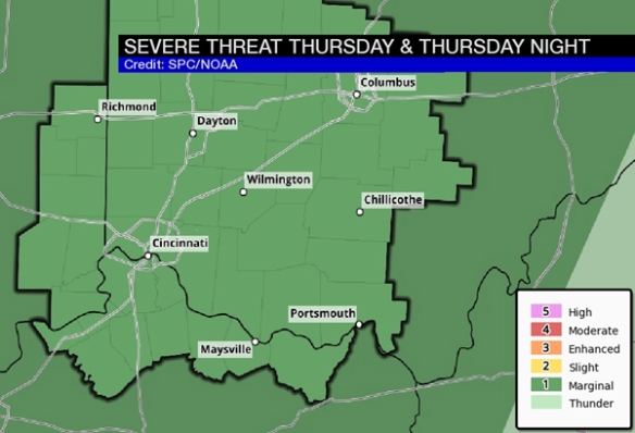
With modest instability, temperatures in the 60s, and dewpoints rising into the 50s, the Storm Prediction Center has placed the entire Tri-State in a marginal risk for severe storms through this evening:
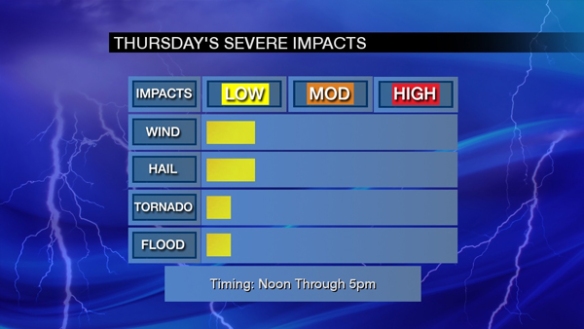
Large hail and strong to damaging-straight line wind is the main threat. The tornado and flooding threat are low at this time. Note the most likely time for any strong or severe storms today will be between noon and 5pm:
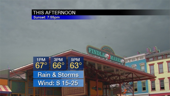
In summary, this afternoon’s forecast calls for a cloudy sky, rain, and storms with a strong wind out of the southwest:
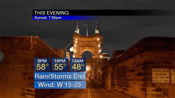
Rain and storms will diminish this evening as colder, drier air moves into the Ohio Valley from the west:
Stay weather aware through early evening!