Early Wednesday morning, the Tri-State was placed in a slight to enhanced risk for severe storms for Friday. This should not be a surprise if you saw my blog post from yesterday. The enhanced risk is northwest of Cincinnati, and the rest of the Tri-State is in the slight risk:
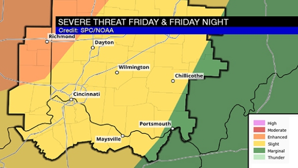
The enhanced risk is the higher risk, and the slight risk is the lower risk.
There will be a main line of rain and storms sweeping through Friday night, but there is also a concern – especially northwest of Cincinnati – for discrete, individual cells or “troublemakers” ahead of the main line late Friday afternoon and early Friday evening. These cells can sometimes be supercellular, but not always. In this case, guidance supports tornadic thunderstorms and supercells over northern and central Indiana, but the threat is more nebulous and conditional in southeastern Indiana.
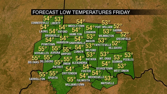
Temperatures will likely be in the mid 50s early Friday morning:
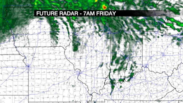
…and the dewpoint will likely be within a couple of degrees of the temperature. Warm, humid air supports the storm threat. Wednesday morning’s NAM model future radar product suggests there will be stray showers – especially northwest of Cincinnati – early Friday morning:
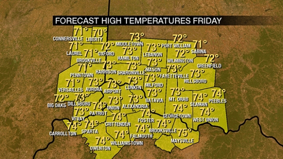
Temperatures will rise into the low and mid 70s Friday afternoon. This kind of warmth fuels storms, especially in February:
Tuesday morning’s NAM model suggests a line of showers and storms will develop to the west of the Tri-State early Friday afternoon:
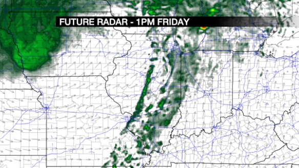
This line is likely to intensify during the afternoon as it pushes east:
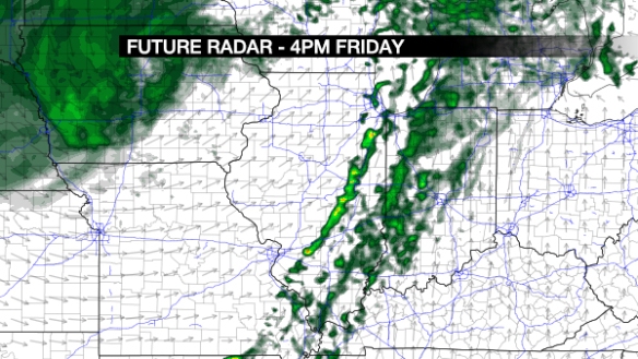
Let’s stop here, and introduce the supercell parameter. What’s that? It’s an index that shows the support for supercell storms and tornadoes. Higher values of the supercell parameter suggest a higher threat for tornadoes, and the NAM model has these high values in northwestern Indiana at 4pm Friday:
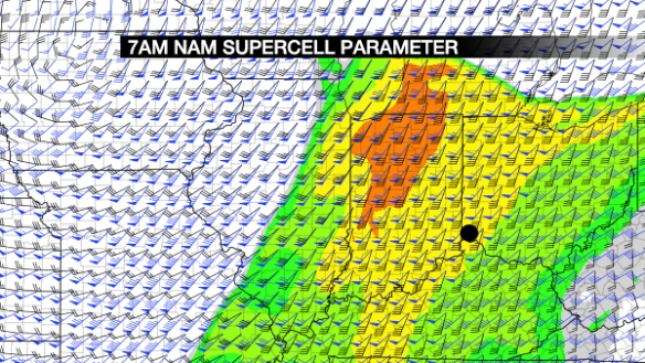
…and a lower, but still significant threat here. The GFS model is not as impressed at 5pm Friday:
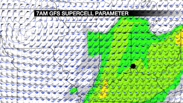
…but it, too, has us in a relatively low threat. Here’s what the NAM model thinks the radar will look like at 7pm Friday:
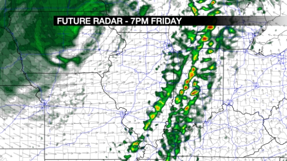
The highest radar echoes are still over Indiana, but the line is marching east. This line will gradually weaken as it moves east, but strong and severe storms are still a possibility Friday evening. My overall thinking on the severe threat late Friday is here:
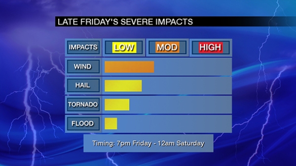
Damaging straight-line, large hail, tornadoes, and flooding are late Friday’s severe weather threats, in that order. Stay alert and be prepared!

Scott. I really appreciate your Severe Storm Updates. I do hope you will keep your brilliance in mind in this tough corporate world. In liu of my rough Latin: “Do not let the bastards get you down”!