
Before sunrise this morning, the Storm Prediction Center pushed much of the Tri-State into an enhanced risk for severe storms Friday:
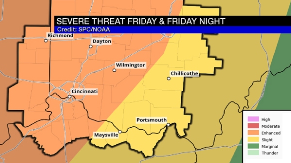
This is an upgrade to the risk from yesterday when the enhanced risk only came into Fayette, Union, and Franklin County of southeastern Indiana. The risk is lower in the southeastern Tri-State.
A line of rain and storms will likely sweep into and through the Tri-State Friday night with discrete, individual cells (potential troublemakers favoring areas along/west/north of I-71 and along/west of I-75).
Much of this bump up in the risk is driven by the tornado threat. SPC’s Short Range Ensemble Forecast “Tornado Ingredients” composite (a mush-mash of tornado parameters with varying weights) has highlighted the Tri-State at 11pm Friday:
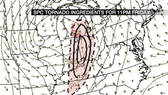
Note that 11pm Friday is not the specific time severe weather is expected in the Tri-State; there is a window, and this time is near the center of that window.
I talked about the SHERB parameter earlier this week in a blog post earlier this week in a blog post; as a review, it has skill in highlighting severe weather areas where there is limited instability and high wind shear (a similar environment to what we have Friday). SHERB values of 1+ signal and elevated threat for severe storms in this mode. Here’s what this morning’s NAM model has for SHERB at 7pm Friday:
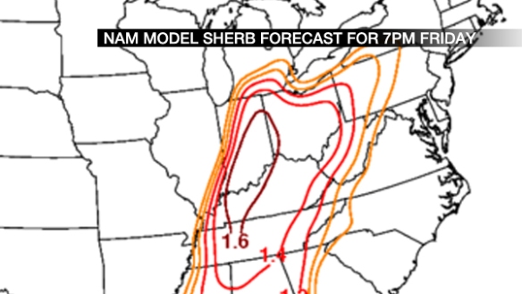
Those values are higher and positioned more to the east than runs earlier this week. Does this morning’s NAM model agree?
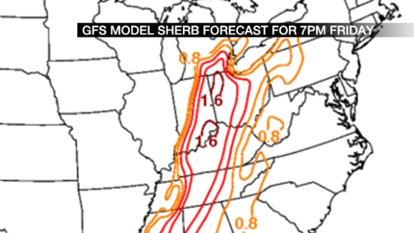
It does, and these values are not extreme, but high. This suggests confidence is rising in strong or severe storms late Friday.
I could show you additional parameters and signals, but ultimately, you need to know the threats and timing. My latest thinking is below:
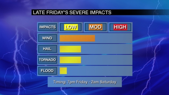
The damaging straight-line wind threat, large hail, and tornado threat have increased since yesterday, but this threat may lower or increase again later today or Friday. Stay alert!