
Thanks to ample sunshine, more supportive temperature profiles in the atmosphere, and an increase in the amount of wind shear over the last few hours, the threat for severe storms remains elevated despite a weak round of storms northeast of Cincinnati now. Radar shows those storms and stronger clusters of storms east and northwest of Cincinnati at this hour:
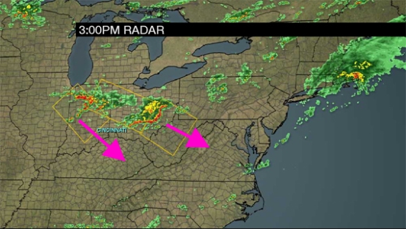
Clusters of storms over central and northern Indiana are the ones to watch. Those will expand in coverage and move southeast this evening.
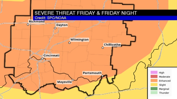
Through midnight, the Tri-State remains in an ENHANCED risk for severe storms:
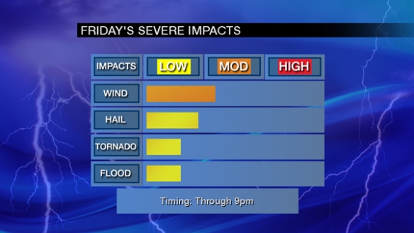
Damaging straight-line is still the main threat with large hail a close secondary threat. Tornadoes and flash flooding are the lowest of the severe threats at this time:
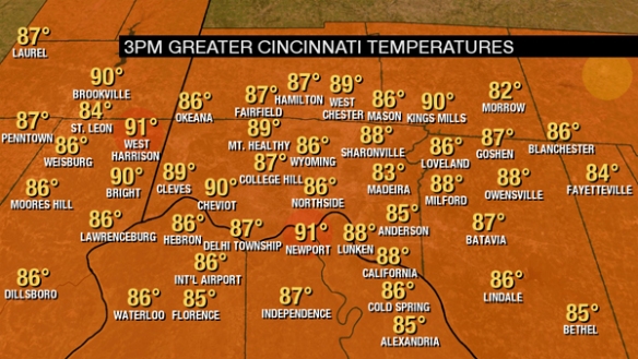
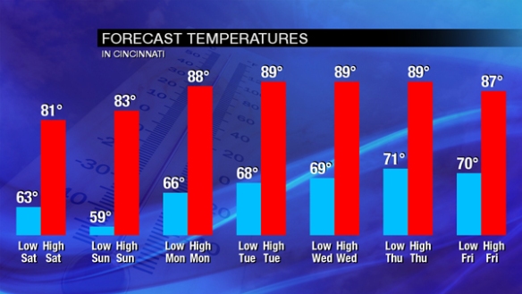
It’s warm outside. Temperatures are in the mid to upper 80s for most as of 3pm:
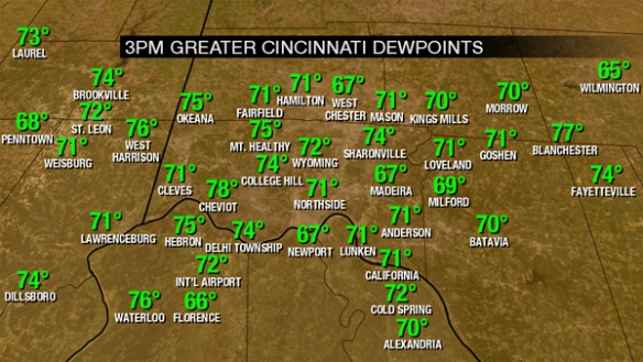
It’s also steamy with dewpoints in the mid 70s:
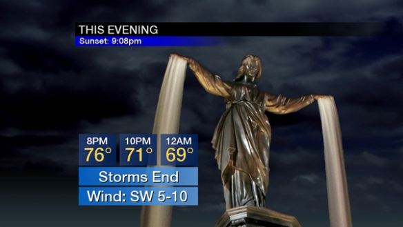
Showers and storms will develop late this afternoon and early this evening. Showers and storms will gradually end nearing midnight. Notice the large drop in temperatures due to showers and thunderstorms:
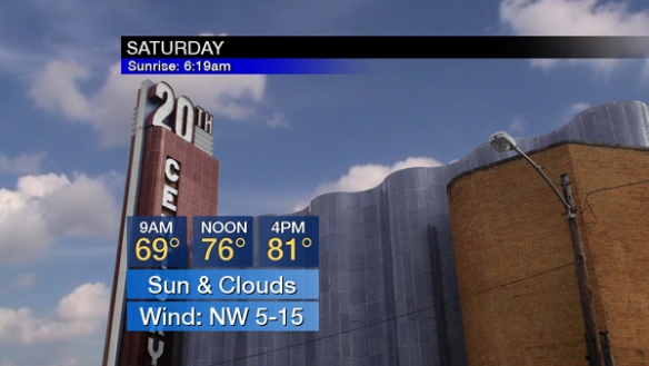
Cooler, less humid air is coming tomorrow. After areas of fog in the morning, a mix of sun and clouds is forecast during the afternoon:
Enjoy the break from heat and humidity this weekend, because both are coming back next week!
You should have multiple ways to get watch and warning information this afternoon and evening. Be alert!