
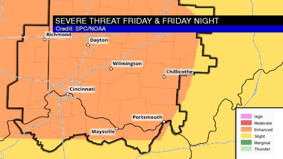
The Storm Prediction Center has placed the entire Tri-State in an ENHANCED risk for severe storms through this evening:
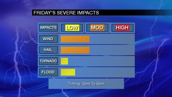
The primary threats this afternoon and evening are damaging straight-line wind and large hail. Flash flooding and tornadoes are secondary threats. All of these threats are in play between 3pm and 8pm today:
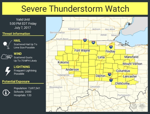
There is already a Severe Thunderstorm WATCH in effect for parts of Ohio and Indiana just north of the Tri-State:
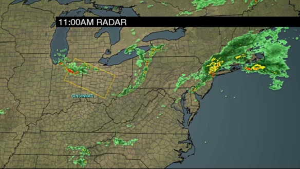
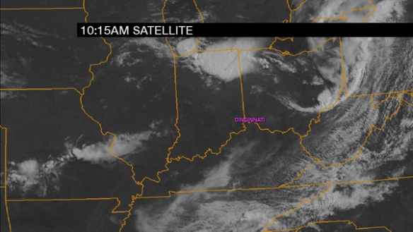
Showers and storms have already developed over northeastern Indiana, and these clusters of showers and thunderstorms will expand in coverage and move southeast over the next several hours:
Ahead of these showers and storms, there is plenty of sunshine:
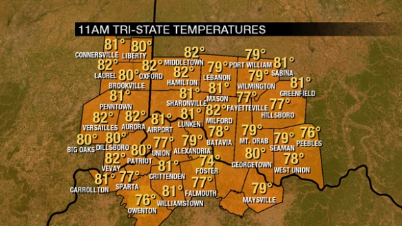
Sunshine will boost instability levels available to storms this afternoon and evening. In addition to sunshine supporting storms, it’s also warm. Temperatures are already in the 70s and 80s, and these numbers are rising:
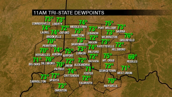
It’s also steamy. Dewpoints are in the low to mid 70s:
The necessary ingredients for severe storms are already in place. Temperatures will rise through the 80s this afternoon with showers and storms developing:
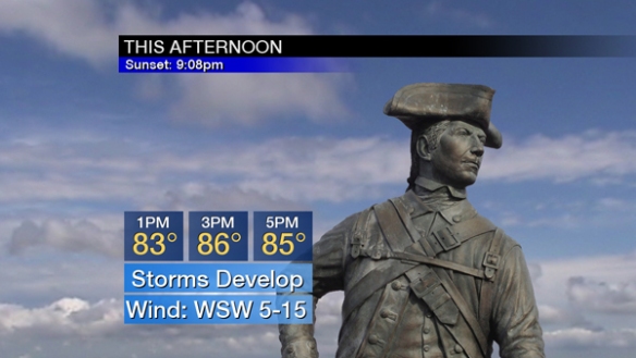
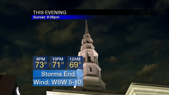
Temperatures will crash through the 80s and 70s this evening underneath the weight of showers and storms:
Have more than one way to get watch and warning information this afternoon and evening!