
It will be cloudy tonight, but no rain, sleet, freezing rain, or snow is forecast until late tomorrow afternoon at the earliest. The latest model guidance continues to have accumulating in the Tri-State this weekend, but this will be a much weaker disturbance than the one that come through Wednesday.
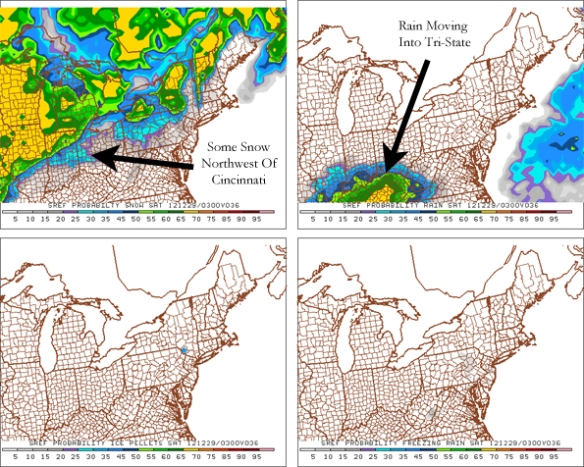
Because this disturbance will be much weaker, snowfall totals will likely be much lower. Before we see accumulating snow, there will be a mix of light rain and snow Friday evening. The latest SREF model shows this mix of rain and snow around 10pm Friday; notice the rain winning out tomorrow evening:
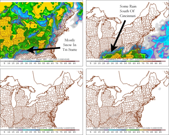
By 7am Saturday, however, the SREF model shows mostly snow in the Cincinnati area:
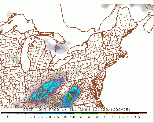
This is likely going to be accumulating snow with temperatures in the upper 20s and lower 30s early Saturday morning. How much? The SREF has a 30-50% chance in the Tri-State (depending on where you live) for 1″+ of snow between 7pm Friday and 7am Sunday:
While this is NOT a forecast, the 7am run of high-resolution ECMWF model is rather aggressive with the threat of accumulating snow Friday night and Saturday:
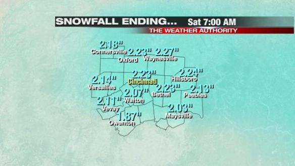
Again, this is raw model data and not a forecast. These numbers appear to be a bit high, but isolated amounts up to 1.5-2″ appear possible with this system. These numbers are preliminary; adjustments are likely in the next 24-36 hours. I would rather ramp totals up than ramp them down. There will likely be some variations in snowfall totals from one Tri-State community to another.
We will release a snowfall forecast in the next 24 hours…stay tuned.