
We are halfway through January, and halfway through meteorological winter. Almost 8″ of snow has fallen since December 1st in Cincinnati, but the main concern will be ice tonight. The best chance for seeing ice outside of your home will be from 9pm to 3am; communities north and west of Cincinnati may see little or no ice, while many south and east of downtown will see a glaze of ice by Wednesday morning.
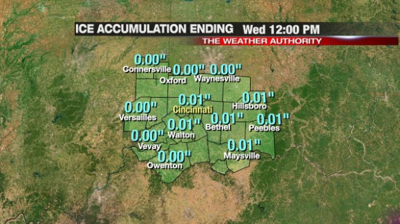
The latest model data disagree on the exact position and amounts of ice, sleet, freezing rain, and snow. PrecisionCast is not excited about our ice accumulation chances tonight:
Microcast is more excited (perhaps too excited) about the threat for ice accumulation tonight:
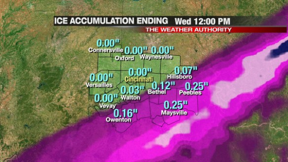
I think that Microcast is overdoing ice amounts, and PrecisionCast is under-doing them. If Microcast were to verify, an Ice Storm or Winter Storm Warning would be issued for several counties south and east of Cincinnati.
Realistically, most along and south of I-71 will get 0.05″ to 0.15″ of ice accumulation through mid-morning Wednesday. Little to no snow is expected with this event, including northwest of Cincinnati. Here’s our thinking on snow and ice in the Tri-State tonight and early tomorrow morning:
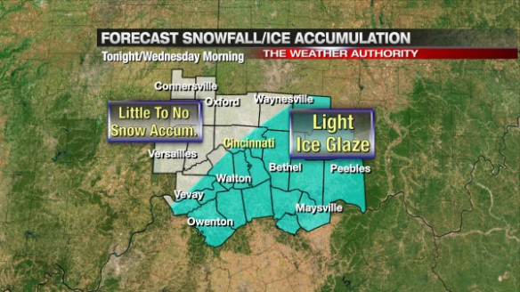
This forecast may change later tonight, but confidence is high that we will have a rain, snow, freezing rain, and sleet mix tonight and early tomorrow.
Use caution traveling tonight and early tomorrow, as roads may be partially covered with ice. Bridges and overpasses will freeze first!