
For those that like warmer air, temperatures will rise to around 50° Saturday afternoon. If you’re not a fan of cold air, you’re not going to like what’s coming next week. Computer forecast models are coming into consensus regarding an upcoming polar plunge.
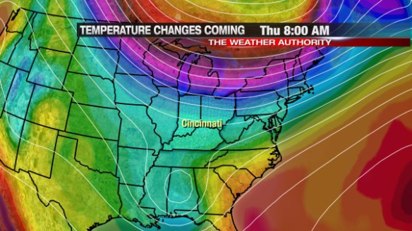
The latest ECMWF model shows arctic air (in purple, maroon, and yellow) north of Cincinnati tomorrow morning:
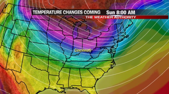
After a brief warmup Saturday, the arctic airmass makes a run to the south. This morning’s ECMWF model has arctic air over much of the Ohio Valley, Great Lakes, and the interior Midwest by 8am Sunday morning:
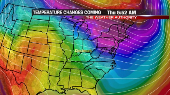
High and low temperatures will likely be well below average through Monday, Tuesday, and Wednesday. By Thursday morning, the latest ECMWF model has a weak ridge of high pressure developing and an increase in warmth over the central United States:
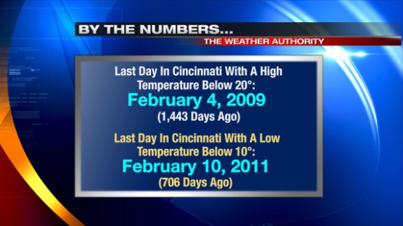
For now, Tuesday looks to be the coldest day in the next seven. Early morning low temperatures are forecast to dip briefly into the single digits, and afternoon highs are forecast to be around 20°.
Does this kind of cold sound familiar? It shouldn’t! It’s been a couple of years since we saw a low temperature below 10° or a high temperature below 20° in Cincinnati:
Enjoy the warmth Saturday because it won’t last long!