
A well-advertised blast of arctic air will be coming soon to the Ohio Valley. We will be on the outer edge of this arctic air mass; the core of cold air will remain over the Great Lakes and southern Canada.
As I mentioned in yesterday’s blog post, the last day with a high temperature below 20° in Cincinnati was on February 4, 2009; the last day with a low temperature below 10° was on February 10, 2011. Cincinnati has only dropped below 10° 74 days in the last 10 winters.
Cincinnati doesn’t always drop below 10° in the winter. Here are the coldest low temperatures we’ve reached during the winter season for the last several years:
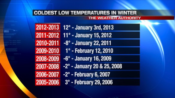
I’m thinking we drop down to 9° by early Tuesday morning in Cincinnati, which will be the coldest temperature of the 2012-2013 winter season so far.
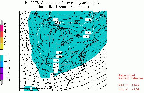
While temperatures will rise and fall some early next week, both high and low temperatures will likely be well below average. The latest GFS model suggests temperatures 5,000 feet above the ground will be 15-20° below average Monday night:
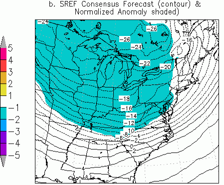
The latest SREF model also suggests temperatures 5,000 feet above the ground will be 15-20° below average Monday night:
Confidence is rising that this below average temperature stretch will end by late next week with a ridge of high pressure and warmth moving in from the west.