
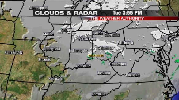
Two disturbances will push through the Ohio Valley between now and midnight; the first will move through over the next couple of hours, and the second will move through later this evening. A satellite and radar snapshot as of 3:55pm shows these two pieces of upper-level energy approaching the Cincinnati area:
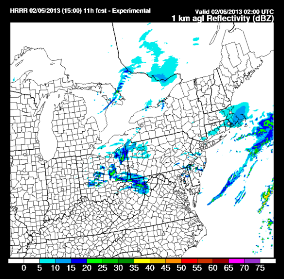
The latest HRRR model’s forecast radar product has flurries favored northeast of the Tri-State around 9pm tonight:
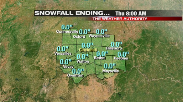
Only flurries are forecast in the Tri-State this evening; little to no accumulation is forecast in and around the Tri-State. The latest run of Precisioncast gives no Tri-State community accumulating snow through tomorrow morning:
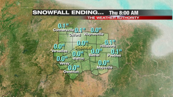
The latest run of Microcast gives us little to no accumulation through tomorrow morning:
Fog and dense fog will be a concern tomorrow morning. Visibilities in spots may be under a 1/2 or even 1/4 of a mile. Once the fog dissipates, ample sunshine is forecast Wednesday. Clouds will increase tomorrow night and Thursday, and a line of showers will sweep through Thursday night and early Friday. The best chance for rain in the next week will be late Sunday and Monday.
While rain will come and go in the week ahead, near or above average temperatures are forecast through the weekend. This morning’s ECMWF model has warm air surging into the Ohio Valley ahead of Thursday night’s cold front:
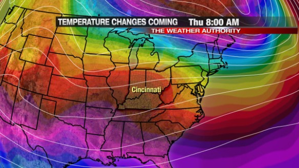
We should make it into the 50s Thursday afternoon. Some colder air will swing into the Ohio Valley Friday and Saturday (highs will be 40-45° each day), but warmth returns to the Tri-State by Sunday night and early Monday:
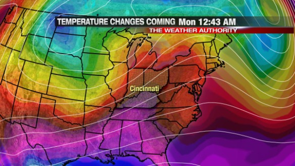
Temperatures will likely each into the 50s both Sunday and Monday afternoon. The latest ECMWF and GFS models bring another shot of cold air into the Tri-State by Tuesday or Wednesday next week.