
Yesterday evening in the weather center, it became very clear that stratus clouds moving in from the north were moving our way, and those clouds were going to be tough to shake today. Why did the forecast need to be adjusted from thinking earlier this week? The answer comes from an understanding in how the temperature changes going away from the ground.
In meteorology, we learn what is going on in the upper-levels of the atmosphere by launching weather balloons across the county. One of those balloons was launched this morning at the National Weather Service forecast office in Wilmington. Meteorologists see wind, temperature, and dewpoint trends from the ground to the upper-levels of the atmosphere on a diagram called a Skew-T. This is the Skew-T from Wilmington from 7am this morning:
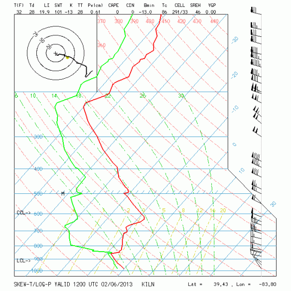
Unless you’re a weather aficionado, you may not be able to make sense of much of much on this diagram. The black line at the bottom of the plot represents the ground and the top of the plot represents the upper-levels of the atmosphere. The red line is the temperature, the green line is the dewpoint, and the black lines in a row on the right side of the plot represent the wind direction and speed. Let’s simplify it…and just look at the temperature in Wilmington at the ground and aloft around 7am this morning:
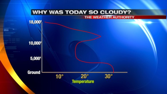
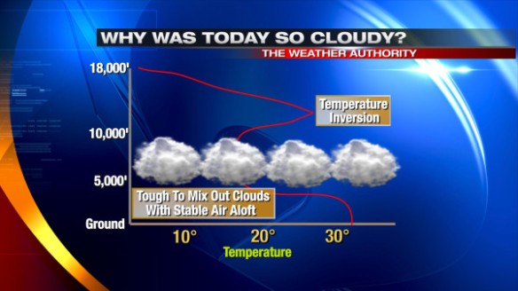
In the graph above, you can see the temperature rise and fall between the ground and 18,000 feet above the ground. Usually, the temperature decreases going away from the ground. In this morning’s case, we see temperatures decrease rising from the ground to 5,000 feet up. Between 10,000 and 15,000 feet above the ground, the temperature increases. In meteorology, this is called a temperature inversion:
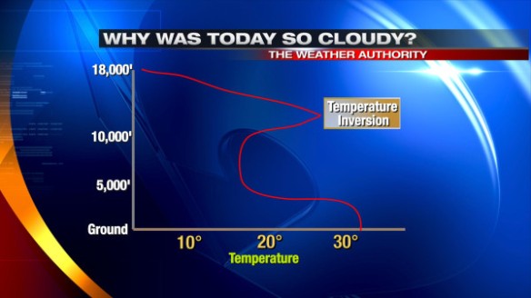
A temperature inversion is another way of saying there is a layer of stable air above the ground. When clouds are trapped below this layer of stable air, they are often slow (and in some cases, very slow) to mix with drier air in the atmosphere, including above the temperature inversion:
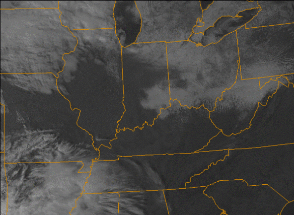
As of 3:45pm, this temperature inversion is holding tough, and clouds persist in and around Cincinnati, while ample sun is found over most of central and eastern Kentucky:
These temperature inversions make forecasting the weather tricky. A difference of 1-3° in the temperature at any given point above the ground can make the difference between quick clearing and slow clearing. Little to no clearing is forecast through mid-evening.
Scott, have a friend in Michigan City that I talked to at my game in Ft. Wayne last night that received 16″ of lake effect Monday night and another 9″ last night. Yikes!