
The top story on the national news this weekend will be a nor’easter pounding New England and the Mid-Atlantic with heavy snow. Models have been reasonably consistent on giving the Boston area at least a foot of snow from Friday through Sunday, but some models are more aggressive than others.
So what’s the latest thinking on how much snow Massachusetts, Connecticut, Maine, New York, New Hampshire, and Vermont are going to get? Let’s start with the snowfall forecast from this morning’s NAM model (through 7am Sunday morning):
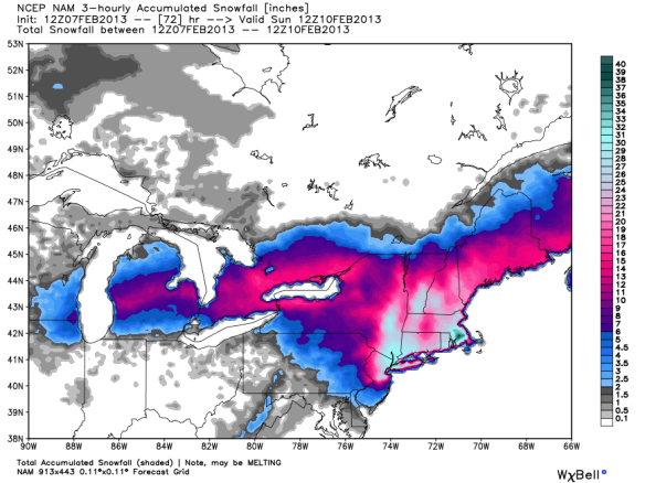
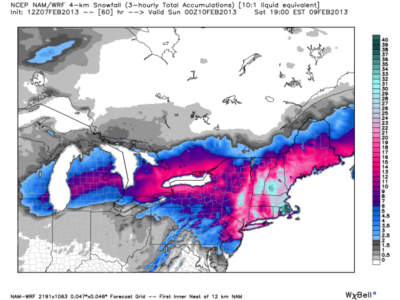
The NAM model says most will get 10-20″ of snow, and some (in the shades of white and dark green) will see 30-40″ of storm total snowfall accumulation. A higher-resolution of this morning’s NAM model run shows similar amounts of snow, but with some higher totals in New Hampshire:
Next up is last night’s GFS model snowfall forecast (through 7am Sunday):
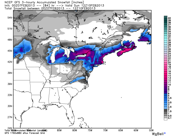
The GFS is clearly not as aggressive with snowfall totals; it gives most of New England 2-10″ of snow with 10-20″ for eastern Massachusetts and downwind of Lake Ontario and Erie. What does last night’s ECMWF think for snowfall amounts Friday through Sunday? Here’s your answer:
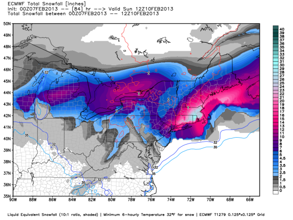
Essentially, the ECMWF model is a blend of the latest GFS and the NAM model runs; the ECMWF gives most of New England 2-10″ of snow and the Boston area 20-30″ of snow.
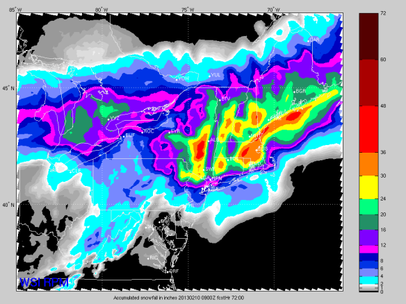
WSI’s RPM model from 7am this morning gives most of New England 5-15″ of snow and areas close to the coast 2’+:
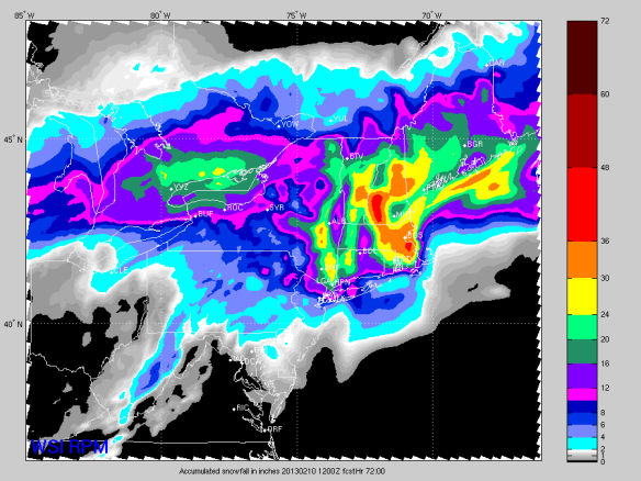
The 4am run of the RPM model looks similar, but different enough to give New England forecasters something to think about:
It is worth noting the the NAM, GFS, and ECMWF maps above assume a 10:1 snow-to-liquid ratio. In other words, the snowfall charts are made with the assumption that 0.1″ of liquid output from the models is equal to 1.5″ of snow in the same spot. This is a low-end approximation for this scenario. Models suggest snow-to-liquid ratios will be closer 15:1 or even 20:1 in spots Friday, Saturday, and early Sunday. This means that the snowfall maps above may be underdoing the amount of snow in spots this weekend.
Analogs (comparing this system to others in the past) suggests most of New England is likely going to get 12-24″ of snow. One of the strongest analogs to this upcoming event is the February 12, 1983 blizzard…which turned New York City into this: http://youtu.be/U9LiWVXpqg4
I don’t envy meteorologists making localized snowfall forecasts for the Mid-Atlantic and New England. This will be a tough forecast. This storm has the potential to be historic not only for snow amounts but also for it’s minimum pressure (how deep the center of low pressure gets). I wish forecasters along the East Coast the best of luck with this one!
First time I have had the art of weather forcasting explained in a way I actually understand modeling and the difficulties involved in such a prediction!Well done Scott!