
While there will be clusters of showers and thunderstorms in and around the Tri-State this evening and also late tonight/early tomorrow, the main threat for severe storms in the Tri-State will come tomorrow night. While tornadoes and large hail will be possible with the strongest storms tomorrow and tomorrow night, damaging straight-line winds will be the main concern.
As a 6:13pm, satellite and radar data showed showers and thunderstorms taking aim on the Tri-State:
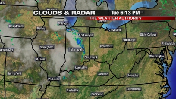
These clusters of showers and thunderstorms will be around through most of the evening.
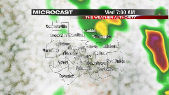
This morning’s Microcast model run has more showers and thunderstorms moving in late tonight and early tomorrow:
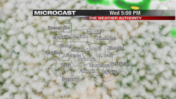
Stronger storms can’t be ruled out both this evening and late tonight, but a much higher threat for severe storms will develop late tomorrow afternoon and tomorrow evening. Microcast isn’t too excited about the coverage of showers and thunderstorms at 5pm Wednesday:
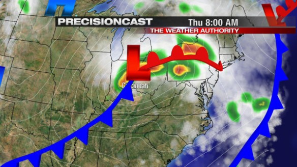
…but tomorrow night is a different story. Precisioncast has a strong area of low pressure coming through the Ohio Valley Wednesday night and early Thursday:
The window for severe storms tomorrow night is fairly large right now. If you buy Precisioncast, strong and severe storms may not arrive until after midnight. Do you like Precisioncast’s thinking, or do you like what the WRF model thinks the radar will look like at midnight Thursday?
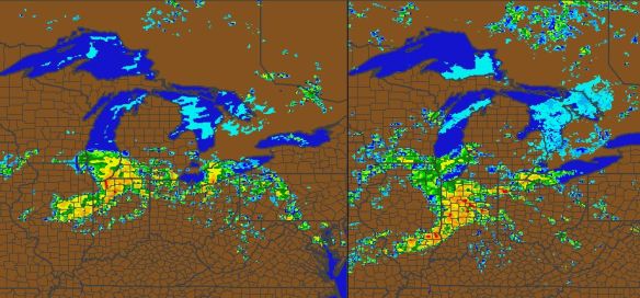
One version of the WRF model’s forecast radar for midnight Thursday is on the left; another version of the WRF is on the right. The difference in the strength and the timing of the showers and thunderstorms is significant, and we aren’t that far away from this event!
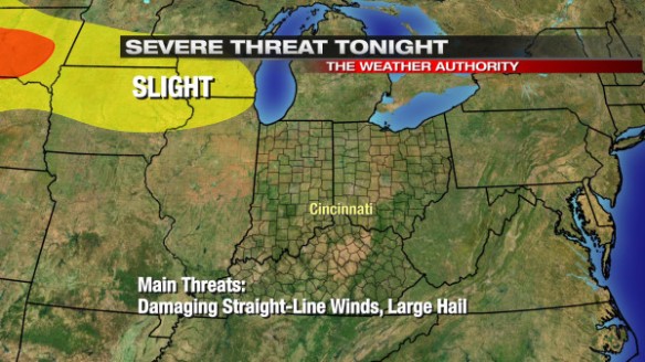
In summary, the Storm Prediction Center keeps the risk for severe storms well off to our northwest tonight:
Most of the Tri-State will be under a MODERATE risk for severe storms from 8am Wednesday to 8am Thursday (the main severe weather threat will be Wednesday night and very early Thursday):
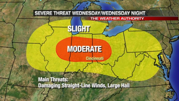
Remember: damaging straight-line winds will be the main severe weather threat Wednesday and Wednesday night. Large hail, tornadoes, and localized flooding will be secondary severe weather concerns.
Are you prepared? Stay tuned for updates!