
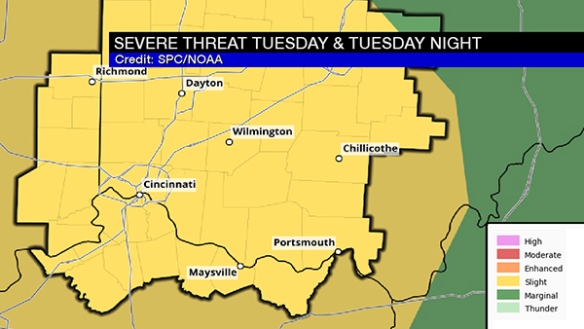
This morning, the Storm Prediction Center placed the entire Tri-State in a slight risk for severe storms on Tuesday and Tuesday evening:
A review of the latest model guidance suggests there will be modest instability (in purple) over the Ohio Valley Tuesday:
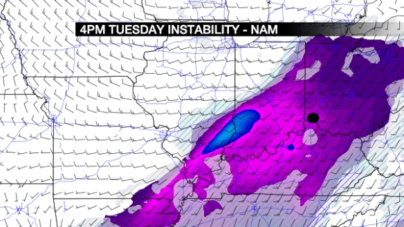
The black dot is Cincinnati. The highest amount of instability will likely be positioned west and southwest of the Tri-State.
The jet stream will be overhead Tuesday afternoon, with the highest wind speeds to the west of the Tri-State. Favored areas for lift in the atmosphere are highlighted in blue:
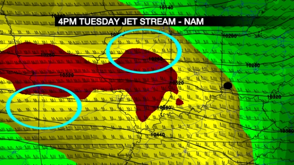
This is not impressive lift over the Tri-State, but it helps. How about the placement of upper-level disturbances? Here’s what Sunday morning’s NAM model things by 4pm Tuesday:
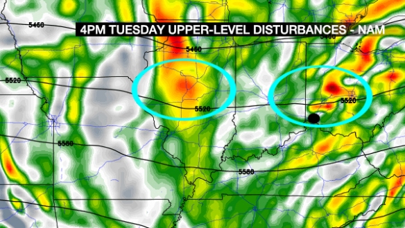
Disturbances are highlighted in blue. Lift in the atmosphere will be highest ahead of these disturbances (which will move from west to east).
How is the tornado threat looking? Let’s assess this threat using the Significant Tornado Parameter (STP). Values of 1 or highest suggest an elevated risk for tornadoes. Here’s what the NAM projects for STP at 4pm Tuesday:
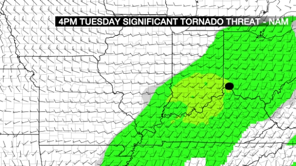
Values of 1+ are in light yellow, so there is a risk for tornadoes Tuesday…BUT it is a secondary threat at this time based on review of other data.
Do we have moisture available to storms? Here’s the dewpoint forecast during the work week:
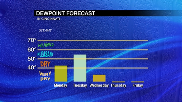
We don’t need to be humid in February to get strong or severe storms, but higher dewpoints suggest an increased likelihood for storms. Dewpoints in the mid 50s is high enough to strong strong storms in the cold season.
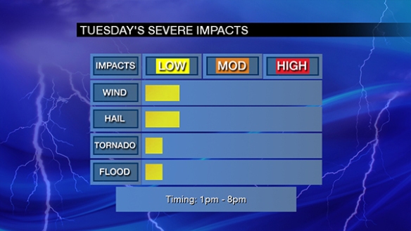
After a review of these parameters and a bunch of other data, the slight risk seems appropriate for Tuesday, with damaging straight-line wind and large hail being the main threats:
I’ll update this threat as time permits on Monday and Tuesday.