
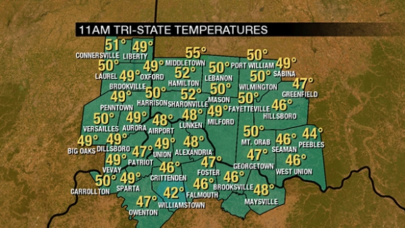
Temperatures have been slow to rise today thanks to soaking rain. As of 11am, temperatures are in the upper 40s and lower 50s:
Dewpoints are in the upper 40s and rising. These numbers will rise through the 50s and to near 60° this afternoon and evening:

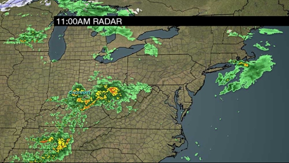
As of 11am, clusters of rain and storms have been marching east through the Tri-State this morning:
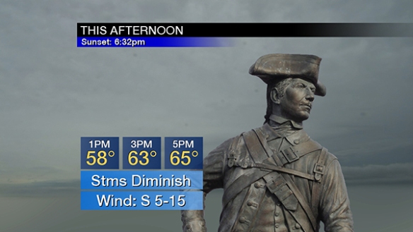
Showers and thunderstorms will decrease in coverage and intensity this afternoon as temperatures rise through the 50s and 60s:
Few if any showers will be floating through the Tri-State late this afternoon and this evening, allowing instability to build and increasing the likelihood for strong and severe storms as a cold front nears from the west:
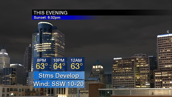
Wind speeds will increase this evening as low pressure to the west deepens.
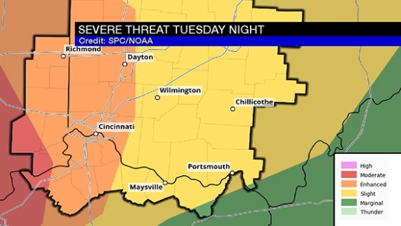
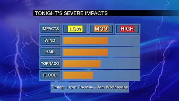
Based on the latest guidance and recent trends, there are two windows of opportunities for severe storms through Wednesday. The first comes between 11pm and 3am tonight. This is the main driver behind the Storm Prediction Center’s enhanced to MODERATE risk for severe storms through sunrise:
Between 11pm and 3am, the main severe weather threats are damaging straight-line wind and large hail. Tornadoes are a secondary threat at this time. Storms that come through will likely sweep through as clusters, not a distinct line:
A secondary wave of strong and severe storms will come between 6am and 10am. With this wave, the main severe weather threats are tornadoes and damaging straight-line. Large hail is a secondary threat at this time:
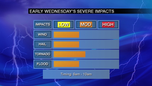
This early morning threat is fueling the Storm Prediction Center’s slight to enhanced risk on Wednesday:

In addition, there is a Flash Flood Watch for most of the Tri-State through 4pm Wednesday:
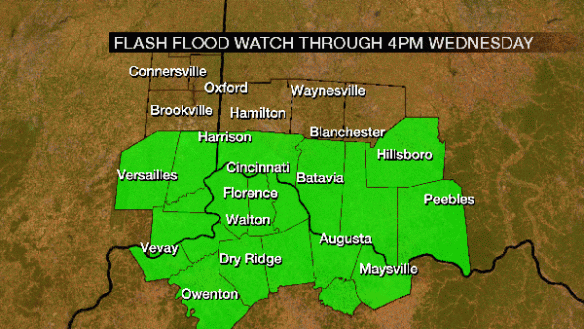
1-2″ of rain will fall tonight and early Wednesday.
Be alert. Have a way to get warnings!