Flooding And Severe Threat Through Saturday Night

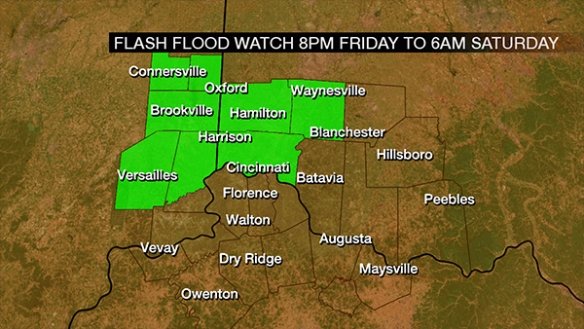
A Flash Flood Watch has been posted for much of southwestern Ohio and southeastern Indiana, thanks in part to saturated soil after last night’s heavy rain:

sep9-ffw

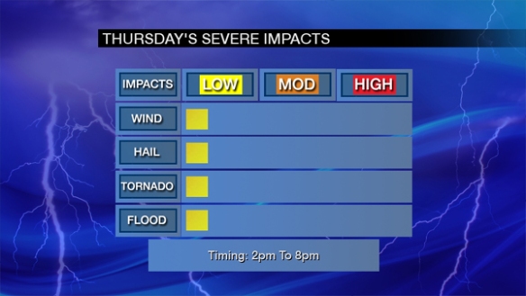
While the coverage of showers will be low through mid-evening, scattered showers and thunderstorms will develop late this evening and early in the overnight. There is a risk for strong storms tonight, but the main concern is flooding and flash flooding in the watch area.

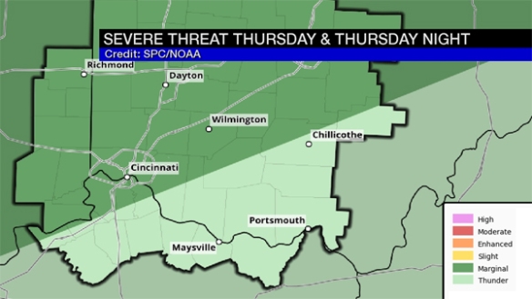
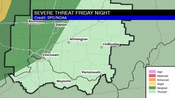
The Storm Prediction Center only has communities northwest of Cincinnati in the marginal risk for severe storms through sunrise:

sep9-spctonight

Even if storms aren’t strong or severe, they may produce heavy rain and frequent lightning.

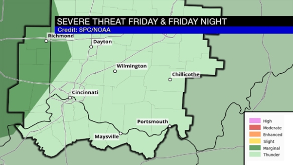
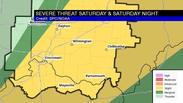
While the Flash Flood Watch will expire at 6am, the threat for flooding and heavy rain returns Saturday afternoon and evening. The threat for strong and severe storms will also be higher Saturday, especially for areas east of Cincinnati:

sep9-spcsaturday

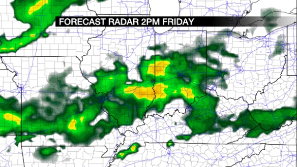
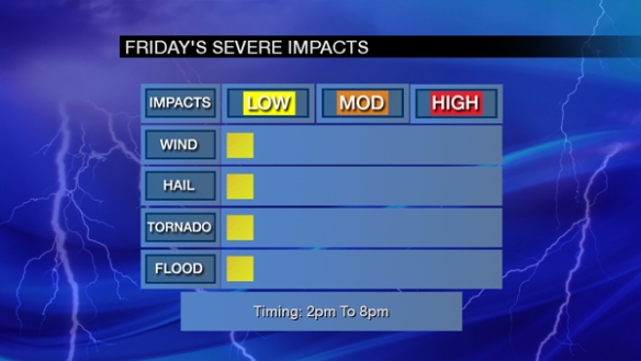
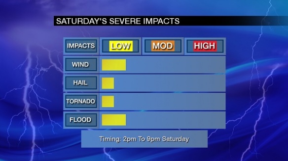
The most likely time for storms – including strong to severe storms – Saturday is 2pm to 9pm. Damaging straight-line wind is the main threat:

sep9-impacts

The key takeaways here are to be aware for flooding and strong storms through Saturday night. The risk for both of these is highest northwest of Cincinnati tonight and along and east/south of I-75 and I-71 Saturday afternoon and evening. Never drive through flooded roads!

A Threat For Strong And Severe Storms Thursday And Friday

While the threat is small, you should be alert for strong and severe storms Thursday and Friday, especially during the afternoon. Even if storms aren’t strong, some cells may produce heavy rain and lightning.

Models are quite sloppy with the coverage and timing of showers and storms Thursday and Friday. Wednesday morning’s NAM model has precipitation developing in the Ohio Valley around 2pm Thursday afternoon:

sep7-2pmthursday

The same model also has showers and storms developing in the Tri-State Friday afternoon:

sep7-2pmfriday

Other models and guidance is not as aggressive with the coverage storms both Thursday and Friday. My forecast for Thursday calls for scattered showers and storms developing, especially during the afternoon and ending in the evening.

The Storm Prediction Center has placed areas west and north of Cincinnati in a marginal risk for severe storms Thursday:

sep7-spcthursday

The marginal risk is farther west in SPC’s severe weather outlook for Friday:

sep7-spcfriday

At this point, all severe weather threats for Thursday and Friday are low and mainly during the afternoon and early evening. Here’s are forecast severe impacts for Thursday:

sep7-thursdaythreats

And here is the breakdown of threat for Friday:

sep7-fridaythreats

Be alert! This threat may change in the next 24 to 48 hours.