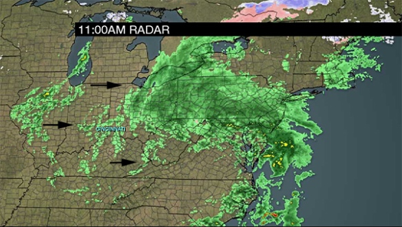
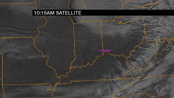
While snow is coming Thursday, the sky will be sunny to mostly sunny this afternoon. A 10:15am cloud snapshot of the Ohio Valley shows some clouds to the northwest moving southeast:
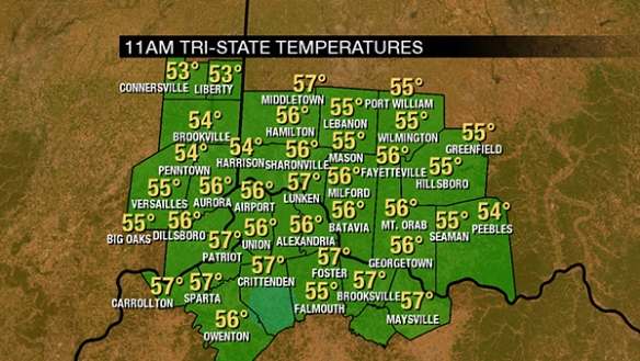
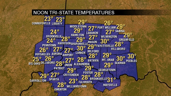
Despite sunshine, it is still cold. As of noon, temperatures are in the mid to upper 20s for most:
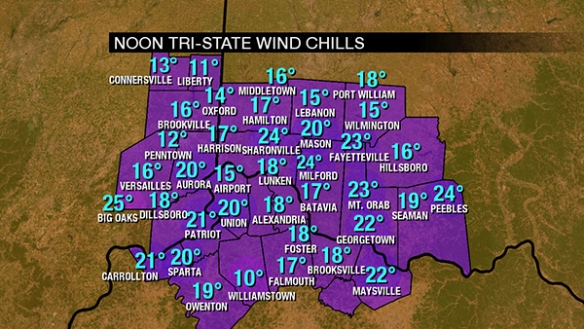
A sustained wind between 10 and 20mph means it feels colder. Wind chills in the Tri-State are in the teens and 20s:
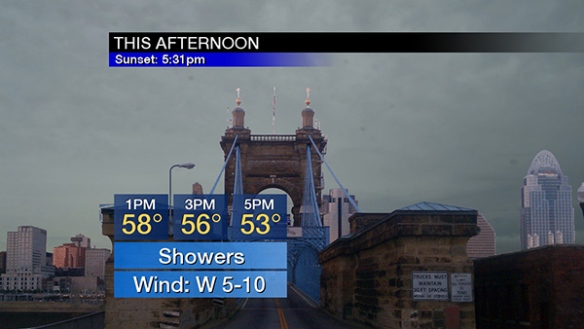
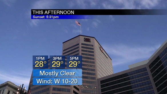
Temperature will barely rise this afternoon thank to a westerly wind dragging cold air in from the Plains and Mississippi:
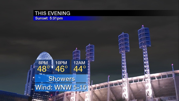
The influence of low pressure will begin tonight in the form of high- and mid-level clouds increasing. Plan for temperatures fall through the 20s:

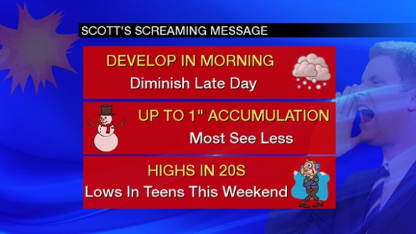
Snow is likely Thursday. The coverage will increase in the morning, be steady for most of the afternoon, and end Thursday evening:
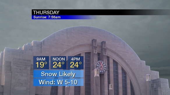
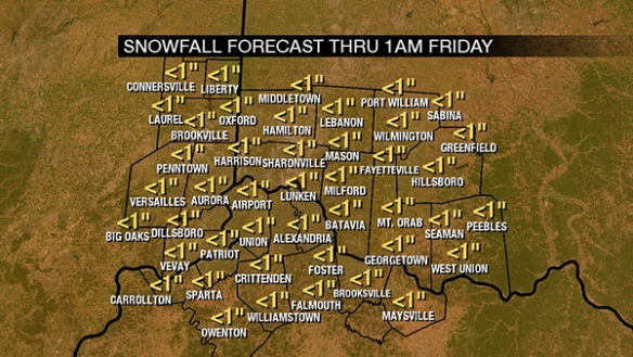
Temperatures in the low to mid 20s will mean snow-to-liquid ratios will be higher than usual. This means that liquid-equivalent precipitation (all forms of precipitation melted down) will need to be multiplied by a factor that is higher than usual. A baseline ratio for temperatures in the upper 20s and low 30s is 10:1. Given that temperatures will be in the low to mid 20s, this snow-to-liquid ratio is more like 18:1. Remember, 10:1 or 18:1 are snow-to-liquid ratios, NOT forecast snow totals. I am explaining the meteorology of taking what forecast models produce to a snow forecast. Models are producing 0.1″ to 0.18″ of liquid for this event (all snow), so totals of 2-4″ totals look appropriate for most, but not all. Here’s what I’m thinking for event total snowfall (Thursday and Thursday night):

This is a significant increase in amounts compared to 24 hours ago. This will not be a winter storm, per se…but it will be significant winter weather event. Roads will at least be wet on Thursday, and they will likely be snowy in spots with pavement temperatures in the 20s. Snow squalls are unlikely tomorrow, but the visibility will be reduced by snow…especially in the late morning and first half of the afternoon Thursday:
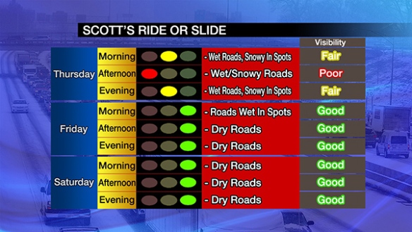
Red lights for travel conditions are somewhat rare for me. Again, this does not appear to be a winter storm, but impacts will be significant!