What You Need To Know About Tomorrow’s Severe Weather Threat

There is a risk for severe storms tomorrow. There is uncertainty in the timing and the strength of thunderstorms tomorrow. I’ll provide updates as the timing and threat changes, but this is the plan for now.

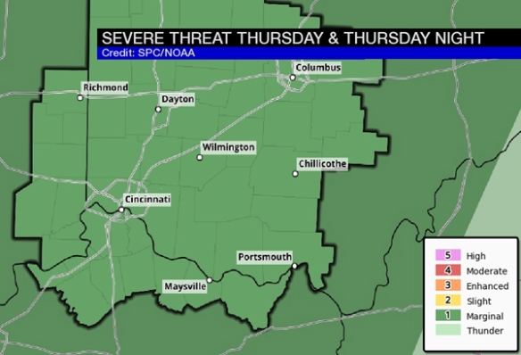
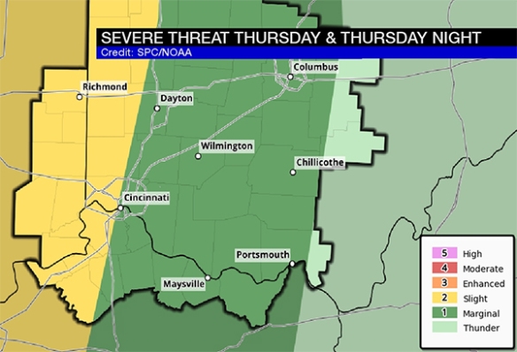
The entire Tri-State is in a marginal to slight risk for severe storms Thursday and Thursday night. The slight risk is basically for communities along and west of I-75; this is where the threat is highest:

mar30-spc-blog

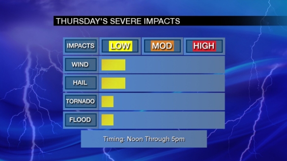
As usual, the threat for damaging straight-line wind and large hail will be highest. Tornado threat is in play, but it is a secondary threat. Here’s are my thoughts how high each threat is:

mar30-threats-blog

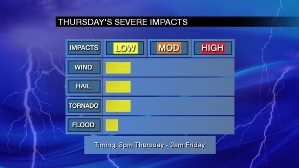
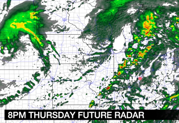
Note that the most likely time for strong to severe storms late in the week is 8pm Thursday to 2am Friday.

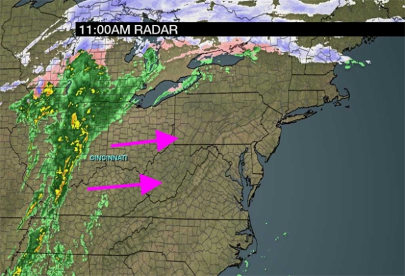
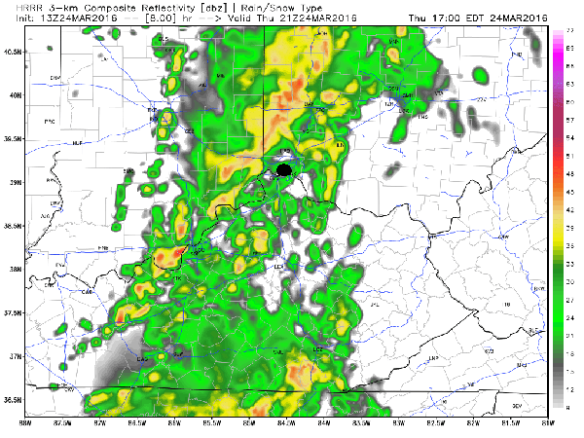
Computer guidance is of little help with the timing and strength of tomorrow’s storms. For the time being, the NAM model appears to be more accurate. It shows rain and isolated storms developing overnight and early Thursday (Cincinnati is the pink dot):

mar30-8amradar

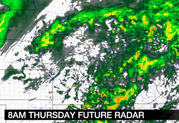
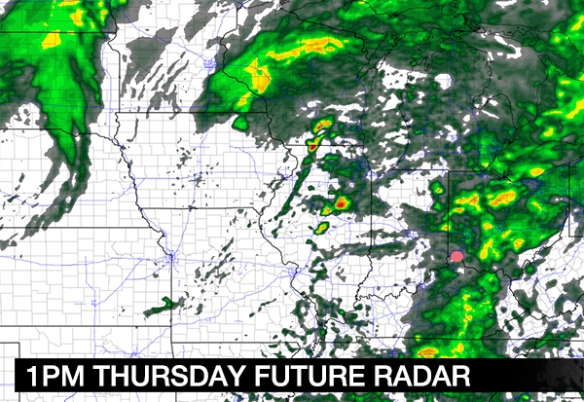
Rain and isolated storms move east of Cincinnati tomorrow morning and early tomorrow afternoon, and partial clearing is forecast during the second half of the day:

mar30-1pmradar

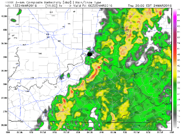
The second round of showers and storms will develop to our west during the afternoon and move east, towards the Tri-State, nearing sunset:

mar30-8pmradar

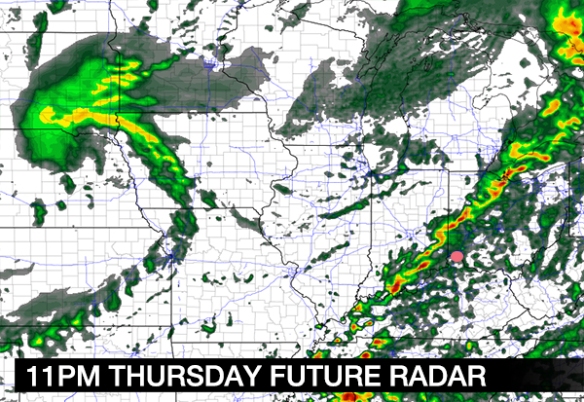
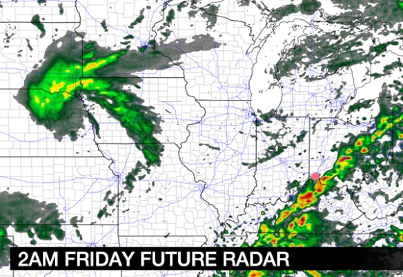
A line of rain and storms will sweep through the Tri-State during the second half of the evening and very early Saturday morning:

mar30-11pmradar

Rain and storms will diminish and end well before sunrise on Friday:

mar30-2amradar

The screaming message here is that rain and isolated storms are forecast overnight and early Thursday and a second round of storms is forecast tomorrow night. Be alert for warnings!

11:20am Weather Update – Including Today’s Severe Threat

Feeling stuffy? The pollen count is high as of 10am this morning…

mar24-aq2

Breezy and windy days tend to have an elevated pollen count. It will probably be high tomorrow.

It’s a warm windy day in the Tri-State. As of 11am, temperatures are already in the mid 60s:

mar24-temps

The wind will be sustained out of the southwest this afternoon between 15 and 30mph. Gusts may be as high as 45mph to 50mph in some Tri-State communities today. A Wind Advisory is in effect through 6pm for the entire Tri-State:

mar24-wind

Radar shows a well-defined line of rain and storms approaching from the west:

mar24-radar

Rain and storms will increase through mid-afternoon. Rain and storms will decrease early this evening. Here’s one one model thinks the radar will look like at 5pm:

mar24-5pm

While rain and storms will be moving through the Tri-State, I believe this model is too slow. The threat for strong storms will be decreasing around and after 5pm. Here’s what the same model thinks the radar will look like at 8pm tonight:

mar24-8pm

With modest instability, temperatures in the 60s, and dewpoints rising into the 50s, the Storm Prediction Center has placed the entire Tri-State in a marginal risk for severe storms through this evening:

mar24-spc

Large hail and strong to damaging-straight line wind is the main threat. The tornado and flooding threat are low at this time. Note the most likely time for any strong or severe storms today will be between noon and 5pm:

mar24-impacts

In summary, this afternoon’s forecast calls for a cloudy sky, rain, and storms with a strong wind out of the southwest:

mar24-afternoon

Rain and storms will diminish this evening as colder, drier air moves into the Ohio Valley from the west:

mar24-evening

Stay weather aware through early evening!